


A pied sur le sentier de la Lavesse


This hike takes you through part of the cross-country skiing area, so popular during the winter season. The world's top biathletes challenge each other on this site all year round... but now, enough daydreaming!...
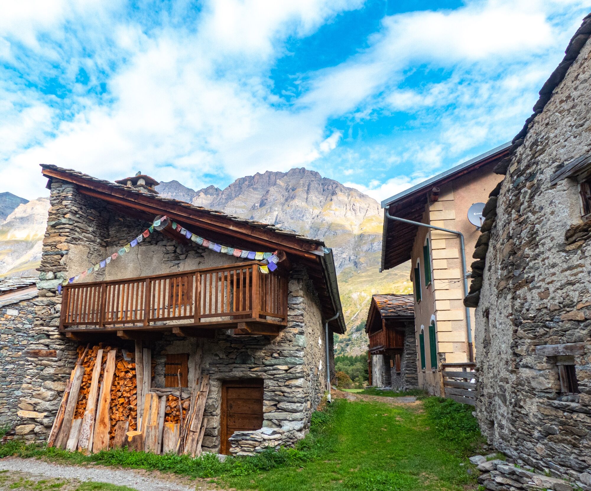
This hike takes you through part of the cross-country skiing area, so popular during the winter season. The world's top biathletes challenge each other on this site all year round... but now, enough daydreaming! *Get motivated and go find the abundant Avérole torrent: as the locals would say "abadez-vous"! The left bank will guide you on a brief adventure into the valley of the same name. At a bend in the road, you come across the beautifully restored hamlet of La Goulaz where the past seems to come back to life. What a surprise in the distance! What's the majestic glacier that just appeared? Her Majesty, the Charbonnel, silently reigns over the land, peaking at 3,752 metres. A mere glimpse leaves you breathless as you venture further on this occasionally uneven slope. In spring, the larch dresses up in shades of intense pink: a jaw-dropping sight! Their new cones bloom in record time, as this evergreen is the only species that entirely renews itself every year. In the summer, they've got a colossal task on their hands!


Pour vous guider sur le terrain, consultez le schéma directionnel « pas à pas » fourni en pdf.
APIDAE Tourismusdaten aktualisiert am 24/07/2022 von "Communauté de communes Haute Maurienne Vanoise".
Haben Sie einen Fehler entdeckt? Schreiben Sie an den Besitzer mit folgenden Hinweisen:
Dateiname: Sentier de la Lavesse | Identifikationsnummer dieser Seite: 5047690 | URL (Link) für diese Outdooractive-Seite.
Beliebte Touren in der Nähe
Le Lac Blanc
leichtWanderung4,42 kmRadanstieg zum Col du Mont-Cenis ab Lanslebourg
schwerRennrad9,84 km- 5,0
Goldtoni - Alpenbogen A068 Refuge de la Leisse-Termignon Val Cenis
mittelFernwanderweg28,7 km Col de l'Iseran depuis Termignon
schwerRennrad38,3 km- 5,0
Arnas - Pian della Mussa Ring
schwerWanderung13,6 km Col du Petit Mont-Cenis
schwerRennrad18,0 km- 5,0
Le Lac du Grand Méan en passant par le cirque des Evettes
schwerWanderung13,6 km Bessans Jadis et Aujourd'hui
leichtThemenweg1,74 kmSee hinter dem Turm und der Rossa, Usseglio
schwerWanderung17,1 kmPetite Haute Mauriennaise
schwerRennrad32,0 km
Wandern & Tracking


Verpasse keine Angebote und Inspirationen für deinen nächsten Urlaub
Deine E-Mail-Adresse wurde in den Verteiler eingetragen.