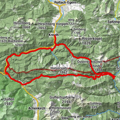
Rottach-Egern / Elendsattel / Silberg / Soinsee / Kühzagl Tegernsee/Schliersee

Mountainbike
Tourdaten
65,03km
720
- 1.499m
2.074hm
2.058hm
03:54h
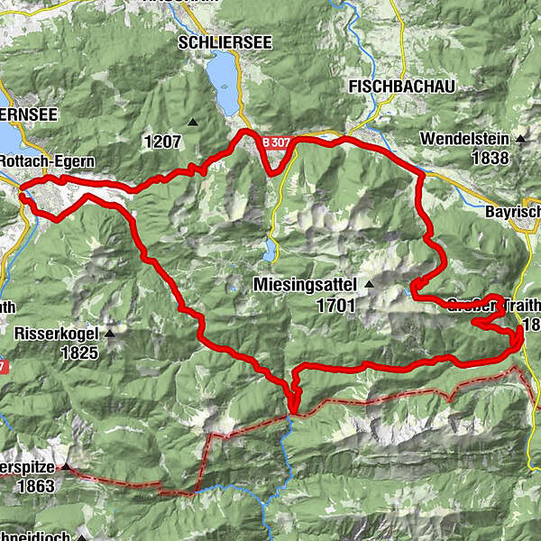
- Wegverlauf
-
Reitrain0,1 kmOberhof0,8 kmEllmau3,4 kmRosskapelle3,6 kmUnterwallberg4,5 kmAlmhof5,5 kmEnterrottach5,5 kmRottachfall6,5 kmWildbachhütte8,2 kmElendsattel (1.143 m)21,1 kmKloo-Ascher Tal26,5 kmSoinalm37,0 kmRuchenkopf-Hütte37,8 kmSchellenberg-Alm38,6 kmGeitau44,1 kmGasthaus-Pension Aiplspitz44,2 kmPostgasthof Rote Wand44,3 kmHeißenbauer45,0 kmHagnberg46,6 kmHammer46,8 kmAurach47,8 kmWölflhof47,9 kmGasthof Mairhofer47,9 kmSt. Josef52,5 kmNeuhaus53,2 kmAlperie53,2 kmSapori Italiani53,3 kmKühzagl-Alm58,1 kmErlach60,6 kmGutenreuth60,7 kmEnzianhütte61,5 kmBrandstatt61,7 kmKalkofen61,7 kmRottach-Egern64,0 kmWeißach64,9 kmReitrain64,9 km
- Höchster Punkt
- 1.499 m
GPS Downloads


Weitere Touren in den Regionen