


A short walk in Saint-Jeannet : Les Baous de la Gaude and St-Jeannet
Points of interest
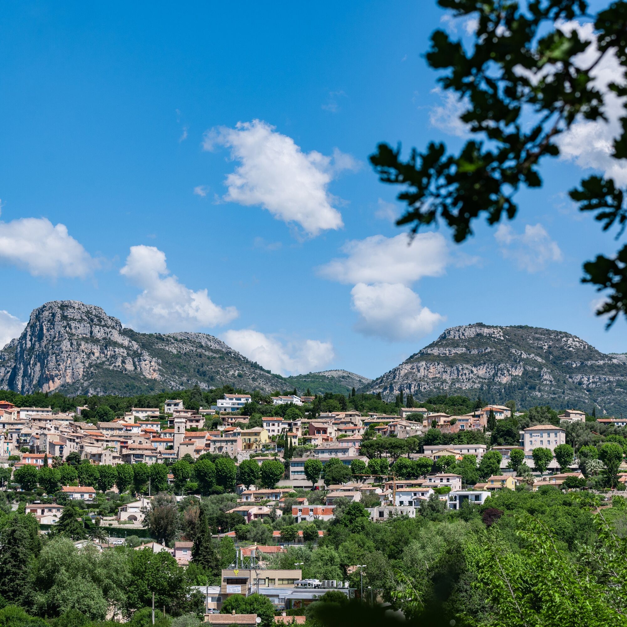
The Provencal village of Saint-Jeannet and its wine production.
The Saint-Jeannet vineyard and its "tuilé" wine. The Rasse family perpetuates this age-old tradition.
Baou de Saint-Jeannet,...
Points of interest
The Provencal village of Saint-Jeannet and its wine production.
The Saint-Jeannet vineyard and its "tuilé" wine. The Rasse family perpetuates this age-old tradition.
Baou de Saint-Jeannet, cradle of modern climbing
Numerous climbing routes can be found on the Baou (Dufranc's record ascent took 15 minutes...).
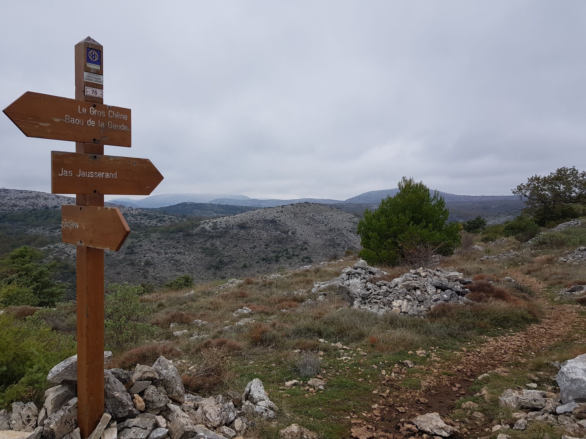
Le Gros chêne
A magnificent oak, several hundred years old and almost 7 m in circumference, impressive for the region.
Le Castellaras
Discover the fortified enclosure at the top of the Baou de la Gaude, witness to the life of our Ligurian ancestors. Follow the yellow signs to discover the northern wall.
The breathtaking history of the Baous
From Jas Jausserand, view of the back of the two Baous.
All outdoor activities in the Nice Côte d'Azur region can be found athttps://outdoor.nicecotedazur.org

From the bus stop or parking lot at the entrance to the village, take the stairs to rue du Vallon, then left into place Sainte Barbe.
Go straight through the village (beacon) and at the washhouse, go up to Place du Verger, and take Rue du Baou, then Chemin du Baou GR®51 (beacon).
On the chemin du Baou, 100 m after the junction with the Baou de Saint-Jeannet (beacon), turn right onto the path leading to the summit of the Baou de la Gaude (beacon).
Here you'll find the Gros Chêne, several hundred years old and measuring 6.7 m in circumference, a former sheepfold and a castellaras (follow the yellow markers to discover the northern wall).
Retrace your steps (beacon) and head due north towards Jas Jausserand (beacon). At Clos de l'Evêque, admire the workmanship of the dry-stone walls and turn left in a hairpin bend, heading south down the Vallon de Parriau. At the signpost, take the path that climbs to the right, heading north-west towards Baou de Saint-Jeannet.
Once on the plateau, turn left due south as far as Baou de Saint-Jeannet, on rocky slabs.
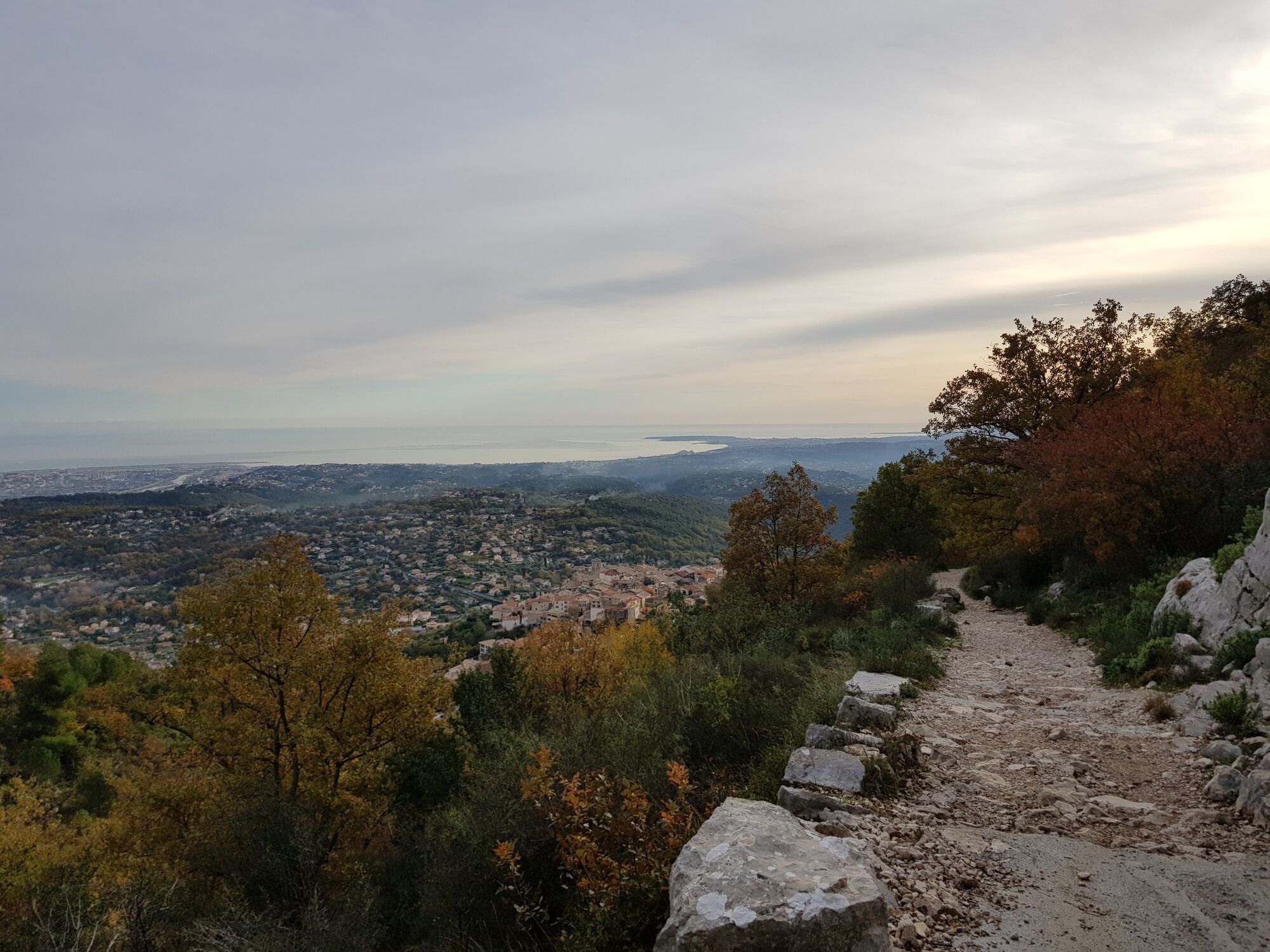
The summit is on the left at the end of the path, where you'll find an orientation table and bench. Enjoy the 360° panorama of the Mediterranean coast and the Mercantour massif.
To return, retrace your steps to marker 85.
Turn left towards the GR®51 (north-west) and follow the yellow markings. The path wanders over a plateau with undergrowth passages, passes to the right of a capitelle (dry-stone hut) and comes out on the GR®51 (signpost).
Take the GR®51 to the right, out of the undergrowth, and follow it to the village of St-Jeannet. Return to your starting point.
Ja
- Walking shoes are recommended
- Bring a backpack with water, a cap, a picnic or a few provisions, and warm, waterproof clothing.
- Flashlight or headlamp if you're going through a tunnel, or to avoid being caught out by nightfall
- First-aid kit
- Find out about local weather conditions before you leave
- Don't overestimate your abilities
- Inform someone close to you of your destination and departure time.
- Use the paths marked in yellow and respect the direction of travel
- Trails are shared: mountain bikers, horse riders and hunters may also use your route.
- Be an eco-citizen: take back your garbage, be discreet so as not to frighten off wild animals and don't pick wild flowers or plants - a photo is enough of a souvenir,
- Respect private property, cultivated areas and natural spaces, and close gates after you've passed through.
- In summer, when the weather is hot, vegetation is very sensitive to the risk of fire, so don't light any fires - you're jeopardizing your own safety and that of others.
The Lignes d'azur network offers a single fare system throughout the Nice Côte d'Azur metropolitan area. Validation is compulsory each time you board the bus, regardless of the ticket used. To consult all fares, click here: www.lignesdazur.com
To get to the start of the tour, stop at the "Saint-Jeannet" terminus:
- Take Line 54 from Nice "Grand Arénas".
Limited parking in the village.
To avoid parking problems: park-and-ride facilities and free shuttles on Saturday and Sunday from 9:30 a.m. to 5:30 p.m. departing from the Prés school.
The summit of Baou de St-Jeannet is ideal for picnics, provided you bring your own garbage.


Beliebte Touren in der Nähe
Kleine Wanderung in Nizza: Rundweg Mont Boron
leichtWanderung 5,13 kmNizza - Aspremont / Route Pagarine (Etappe 1)
mittelWanderung 15,8 km- 4,0
Kleine Wanderung in Aspremont: Rundweg Mont Chauve
leichtWanderung 6,49 km FFC Fahrradstrecke Nr. 5: auf den Straßen der Tour de France (Große Schleife)
mittelRennrad 74,2 km- 5,0
Goldtoni - Alpenbogen A082 Drap-Nizza
leichtFernwanderweg 26,4 km Grande Randonnée® de Pays: Lou Camin Nissart
schwerFernwanderweg 44,7 kmFFC Radstrecke Nr. 8: die Strecke 70.3 (Halb-IRONMAN)
mittelRennrad 92,8 kmFFC Fahrradstrecke Nr. 7: Runde von Vence
leichtRennrad 57,7 kmDie "Route des Paysages" zwischen der Küste und dem Mittelgebirge von Nizza
leichtMotorrad 147,7 kmFFC-MTB-Strecke Nr. 25: Der Gipfel von Broc
mittelMountainbike 18,9 km
Wandern & Tracking


Verpasse keine Angebote und Inspirationen für deinen nächsten Urlaub
Deine E-Mail-Adresse wurde in den Verteiler eingetragen.