


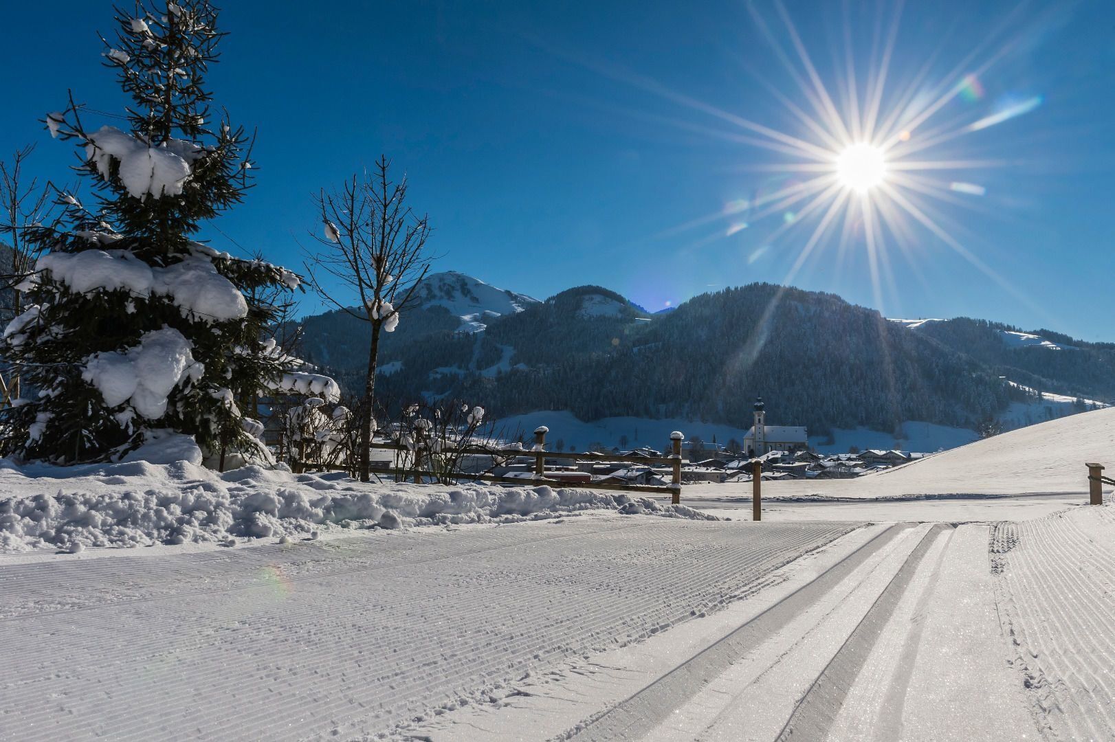
Sunnseit cross-country trail
The Sunnseit cross-country trail is a skating and classic trail. The tour can be small or large. Start is behind the Spar supermarket in the direction of the Wies & Wald districts. At the Lederer farm...
The Sunnseit cross-country trail is a skating and classic trail. The tour can be small or large. Start is behind the Spar supermarket in the direction of the Wies & Wald districts. At the Lederer farm you can decide whether you want to continue the little circuit in the Pirchmoos district or head to the Badhaus inn and return to the village via the Reit district, which is moderately difficult.
Heading from Wörgl, Kufstein or St. Johann on the B178 road, take the exit to Söll and then take the exit to Söll centre (“Söll, Zentrum”) at the roundabout. Turn left immediately afterwards and follow the road. Then turn right at the next intersection (opposite SPAR supermarket). West Pölven public car park is located to the east of the supermarket car park.
Postbus stop “Söll Dorf”
West Pölven public car park, Söll (689 m) – free
Beliebte Touren in der Nähe
- 4,7
Musikantensteig zur Naunspitze
mittelWanderung 8,96 km - 4,5
Über Hintersteinersee und Walleralm aufs Hochegg
leichtWanderung 12,2 km - 4,5
Wanderung um den Hintersteinersee
leichtWanderung 5,29 km - 4,6
Hintersteinersee
mittelWanderung 9,87 km - 5,0
Stripsenjoch Klettersteige/ Rundwanderung von Griesener Alm über Stripsenjochhaus und Feldberg
mittelKlettersteig 10,2 km - 4,9
Route 209: Brechhornhaus-Choralpe
schwerMountainbike 24,4 km - 4,2
Bergdoktor Wohnhaus "Gruberhof" (Köpfing Hof) Rundeweg-Söll
leichtWanderung 8,70 km - 5,0
Kirchdorf: Stripsenjoch Klettersteige
schwerKlettersteig 3,76 km - 4,8
Rosskopf
leichtWanderung 7,02 km - 4,9
Ellmauer Tor (22.07.2020)
mittelWanderung 9,32 km

Wandern & Tracking


Verpasse keine Angebote und Inspirationen für deinen nächsten Urlaub
Deine E-Mail-Adresse wurde in den Verteiler eingetragen.