Romanshorn - Katholische Kirche St. Johannes Baptist - Katholische Kirche St. Notker - Im Bahnhof
leicht
Navigieren
Navigieren
Hol diese Tour auf dein Handy
Romanshorn - Katholische Kirche St. Johannes Baptist - Katholische Kirche St. Notker - Im Bahnhof
leicht
Radfahren
36,48
km
QR-Code scannen und Navigation in der bergfex App beginnen

Wandern & Tracking


Romanshorn - Katholische Kirche St. Johannes Baptist - Katholische Kirche St. Notker - Im Bahnhof
leicht
Distanz
36,48
km
Dauer
02:29
h
Aufstieg
114
hm
Seehöhe
397 -
592
m
Track-Download
Romanshorn - Katholische Kirche St. Johannes Baptist - Katholische Kirche St. Notker - Im Bahnhof
leicht
Radfahren
36,48
km
Wegverlauf
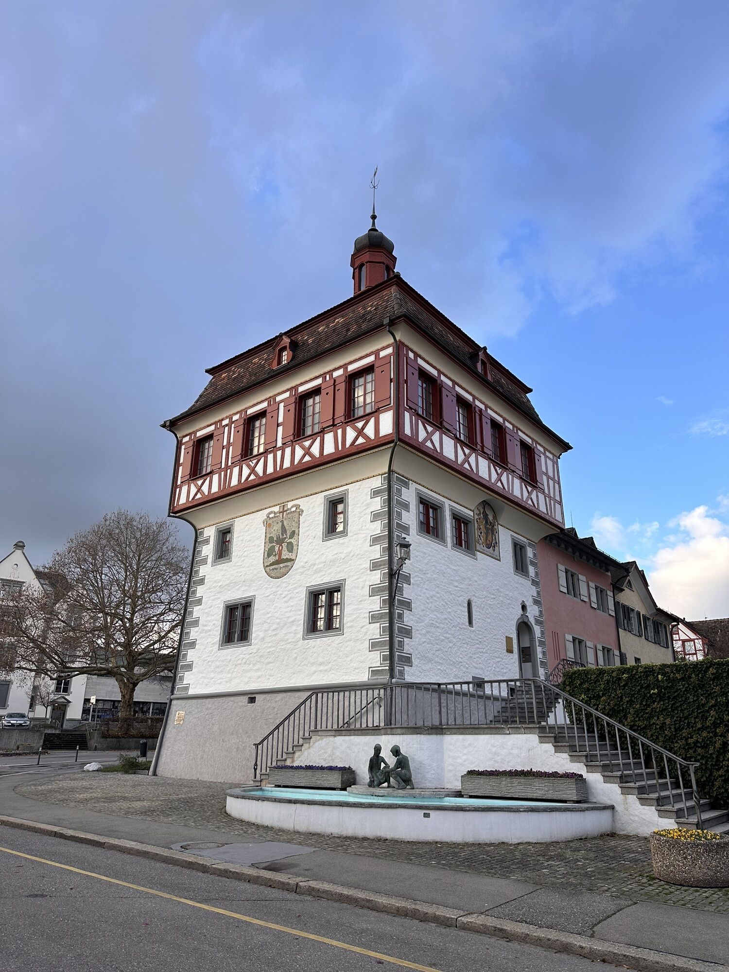
Romanshorn
(401 m)
Stadt
0,0 km
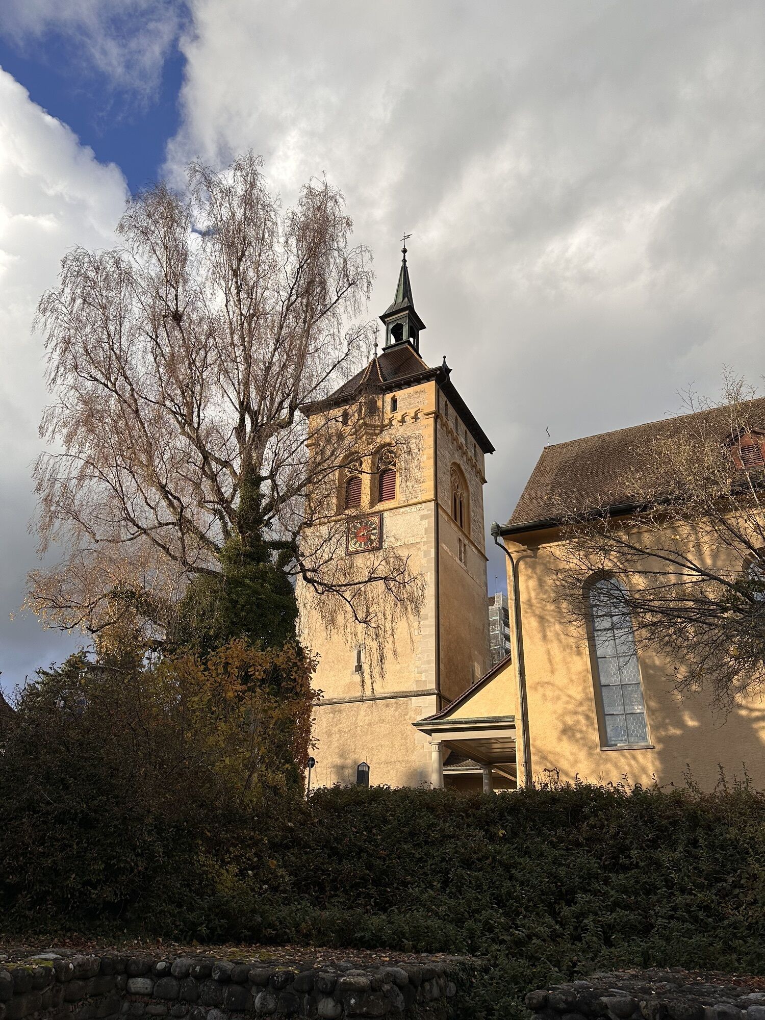
Katholische Kirche St. Johannes Baptist
(483 m)
Andachtsstätte
8,3 km
Katholische Kirche St. Notker
(571 m)
Andachtsstätte
14,5 km
Sankt Gallen
(675 m)
Stadt
18,5 km
Wilen
(569 m)
Siedlung
19,2 km
Sankt Martin
(402 m)
Andachtsstätte
27,8 km
Romanshorn
(401 m)
Stadt
36,5 km
Wegverlauf
Romanshorn - Katholische Kirche St. Johannes Baptist - Katholische Kirche St. Notker - Im Bahnhof
leicht
Radfahren
36,48
km
Romanshorn
(401 m)
Stadt
0,0 km
Im Bahnhof
(399 m)
Stadtviertel
0,0 km
Salmsach
(400 m)
Dorf
1,3 km
Hungerbühl
(413 m)
Siedlung
2,6 km
Langgreut
(424 m)
Siedlung
3,4 km
Stickelholz
(424 m)
Siedlung
3,8 km
Dornhof Gastronomie GmbH
(445 m)
Restaurant
5,0 km
Steinebrunn
(449 m)
Dorf
5,3 km
Almensberg
(465 m)
Siedlung
6,5 km
Hagenwil b. Amriswil
(489 m)
Dorf
8,2 km
Katholische Kirche St. Johannes Baptist
(483 m)
Andachtsstätte
8,3 km
Wasserschloss Hagenwil
(490 m)
Restaurant
8,4 km
Hueb
(512 m)
Siedlung
9,1 km
Sibenhusen
(518 m)
Siedlung
9,6 km
Grüenholz
(523 m)
Siedlung
10,5 km
Chatzensteig
(524 m)
Flur/Gelände
10,7 km
Rohrenmoos
(527 m)
Siedlung
12,7 km
Kultur im Bären
(568 m)
Restaurant
14,4 km
Katholische Kirche St. Notker
(571 m)
Andachtsstätte
14,5 km
Häggenschwil
(571 m)
Dorf
14,7 km
Schöntal
(558 m)
Siedlung
15,3 km
Chrüzegg
(565 m)
Siedlung
15,5 km
Ruggisberg
(581 m)
Siedlung
16,8 km
Zälgli
(574 m)
Flur/Gelände
16,9 km
Zwingensteinhub
(585 m)
Siedlung
17,5 km
Rütihof
(586 m)
Siedlung
18,0 km
Unterrüti
(589 m)
Siedlung
18,1 km
Dottenwil
(592 m)
Siedlung
18,4 km
Sankt Gallen
(675 m)
Stadt
18,5 km
Wilen
(569 m)
Siedlung
19,2 km
Hohenbühl
(567 m)
Siedlung
19,6 km
Freidorf TG
(532 m)
Dorf
20,4 km
Zur Baumühle
(466 m)
Flur/Gelände
21,7 km
Roggwil TG
(438 m)
Dorf
22,6 km
Ochsen
(437 m)
Restaurant
22,6 km
Tres Amigos
(436 m)
Restaurant
22,6 km
Evangelische Kirche
(435 m)
Andachtsstätte
22,7 km
Linde
(427 m)
Restaurant
22,9 km
Stachen
(413 m)
Siedlung
24,3 km
Arbon
(413 m)
Stadt
26,6 km
Sankt Martin
(402 m)
Andachtsstätte
27,8 km
Strandbadrestaurant
(400 m)
Restaurant
30,3 km
Seehuus Bistro
(400 m)
Restaurant
32,0 km
Egnach
(403 m)
Dorf
33,5 km
Restaurant Sternen
(402 m)
Restaurant
33,6 km
Mooswiesen
(402 m)
Stadtviertel
34,1 km
Seewiesenzelg
(400 m)
Stadtviertel
34,2 km
Salmsach
(400 m)
Dorf
35,0 km
Im Bahnhof
(399 m)
Stadtviertel
36,4 km
Romanshorn
(401 m)
Stadt
36,5 km
Noch keine Bewertungen
Beliebte Touren in der Nähe
- 3,2
Bodenseeradweg
Radfahren 210,8 km - 5,0
Grub SG/Heiden Bhf+Kiosk/GrubSG
leichtWanderung 5,38 km Auf die Räder, fertig. Urlaub! Die Bodensee-Radstory WIR SAGEN SERVUS, GRÜEZI UND HALLO
mittelRadfahren 95,8 km- 5,0
Kaienspitz über Heiden und Grub
leichtWanderung 15,8 km Auf die Räder, fertig. Urlaub! Die Bodensee-Radstory AUF EIN GRÜEZI IN DIE SCHWEIZ
schwerRadfahren 71,9 kmGalgentobelwanderung
leichtWanderung 14,2 kmBregenz - St. Sebastian - Katholische Kirche St. Kolumban und Konstantius - Im Bahnhof
leichtRadfahren 51,9 kmWinterwanderung Rehetobel
leichtWanderung 5,41 km- 5,0
Kleine Runde ab Heiden
leichtWanderung 7,71 km Sitterstrandweg von St. Gallen nach Bernhardzell
leichtWanderung 14,3 km

Wandern & Tracking

Über 550.000 Tourenvorschläge, detailliertes Kartenmaterial und ein intuitiver Routenplaner machen die App zum Must-have für alle Naturbegeisterten.

Verpasse keine Angebote und Inspirationen für deinen nächsten Urlaub
Zum Newsletter anmelden
Fehler
Ein Fehler ist aufgetreten. Bitte versuche es erneut.Vielen Dank für deine Anmeldung
Deine E-Mail-Adresse wurde in den Verteiler eingetragen.
Touren in ganz Europa
Österreich Schweiz Deutschland Italien Slowenien Frankreich Niederlande Belgien Polen Liechtenstein Tschechien Slowakei Spanien Kroatien Bosnien und Herzegowina Luxemburg Andorra Portugal Island Vereinigtes Königreich Irland Griechenland Albanien Nordmazedonien Malta Norwegen Montenegro Moldau Kosovo Ungarn San Marino Rumänien Estland Lettland Belarus Zypern Litauen Serbien Bulgarien Monaco Dänemark Schweden Finnland