


Moselsteig Trail Stage 16: Neef – Ediger-Eller

The stage between Neef and Ediger-Eller is the shortest of the 24 legs – but it's definitely not the easiest one: the Moselsteig Trail crosses Europe's steepest vineyard, the Bremmer Calmont. The climb...
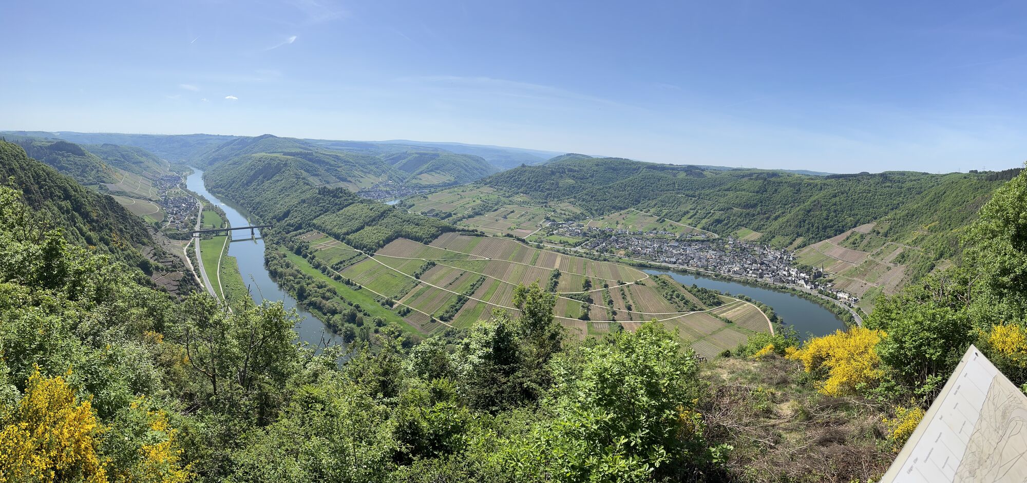
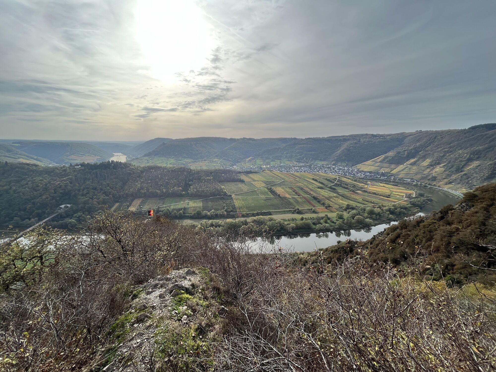
The stage between Neef and Ediger-Eller is the shortest of the 24 legs – but it's definitely not the easiest one: the Moselsteig Trail crosses Europe's steepest vineyard, the Bremmer Calmont. The climb around the hairpin bends is a challenging one, but you are rewarded at the top by a viewing platform that boasts one the most wonderful views of the entire Moselsteig Trail. A little further on, your gaze is drawn to the ruins of Stuben Monastery deep in the valley and the legendary 'Vierseenblick', the view of four lakes – where the Moselle looks as if it has been divided into four separate sections. Experienced hikers with a head for heights might also like to tackle the thrilling Calmont via ferrata, scaling the steep slopes up to the ridge on steps and ladders. The trail nears its finish point along an idyllic path through the vineyards to Ediger-Eller.
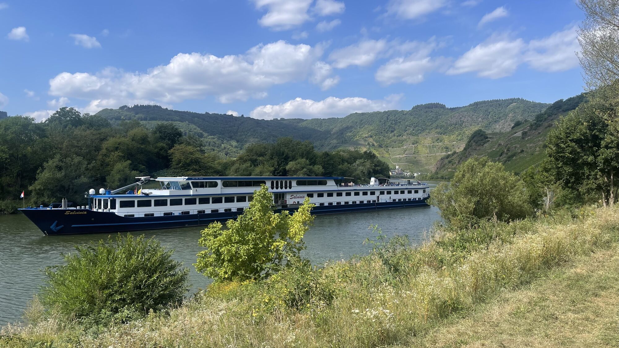
This leg starts in the Petersbergstraße. A few metres away from the railway station, you start this short but challenging Moselsteig Trail leg in the centre of Neef. You quickly reach the outskirts of the town and the Moselle Bridge. From the bridge, you can already catch a view of Petersberg and the Neef summit - you will experience these sites from the most various perspectives. Once you have arrived on the other side of the Moselle, the path takes you through gardens and vineyards and gets closer to the outskirts of Bremm. If you still need to get some provisions, you can walk into the town on the signposted access route - and then join the Moselsteig Trail in direction Ediger-Eller via a different access route. For hikers on the main path, the trail remains close to the town and continues at a slight incline through vineyards until you need to cross the country road. This is where the actual ascent to the Calmont summit starts.
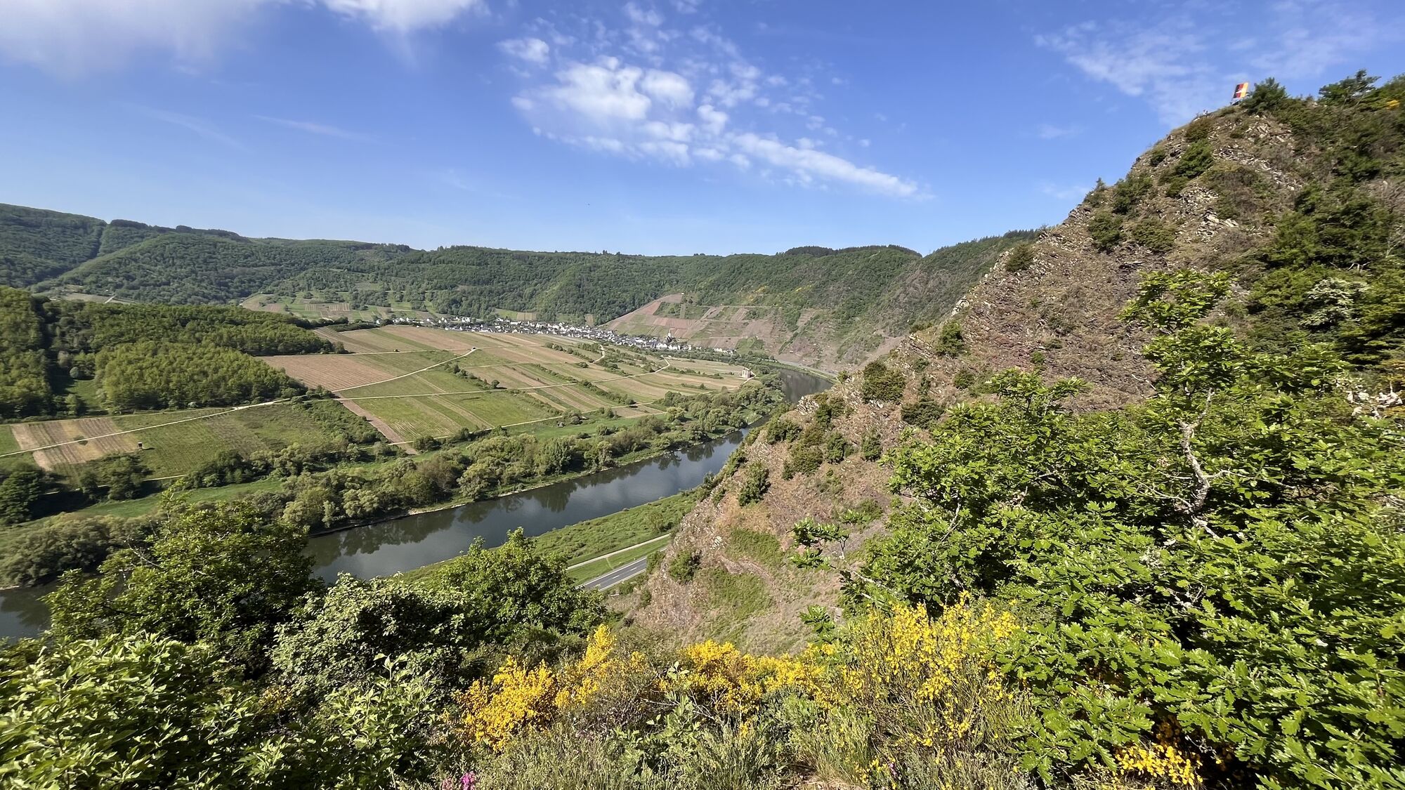
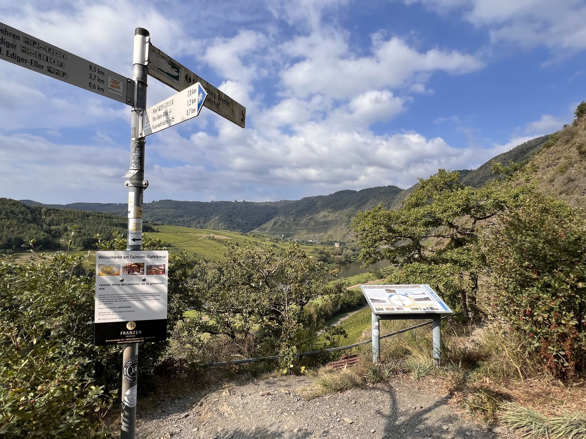
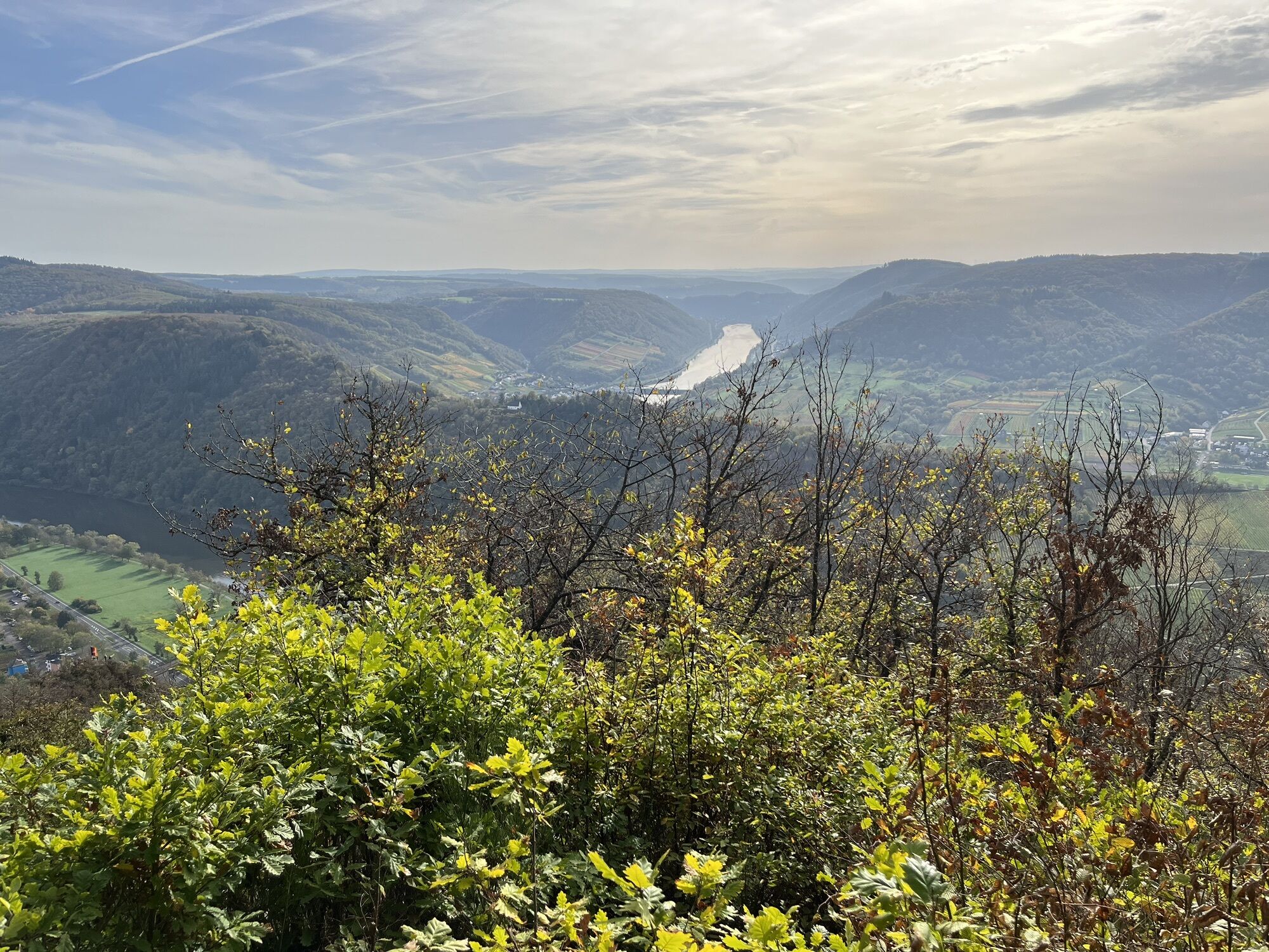
The trail, accompanied by a “stations of the cross path”, continues steeply uphill in serpentines. Follow the steep path until you reach the Bremm mountain chapel. Here, the incline eases a little. Continue a little further on the path, and the trail becomes wider and leads through a steep, wooded hillside. You have now reached the highest point of the leg, the almost 400 m high Schneeberg. The resting area is exactly what you need now. On a level or slightly descending path, you now hike past a large field into a coniferous forest. Finally, the Moselsteig Trail reaches the slope edge and the summit cross on the Calmont. The view here is one of the finest on the entire Moselsteig Trail! You can see the entire route of today’s leg. In flying weather you can watch hang gliders and paragliders, and in season, there is also an open wine bar (check the opening hours).
The Moselsteig Trail now continues over the Calmont summit ridge which slopes steeply on both sides: to the Moselle Valley on the one side, and the Ellerbachtal on the other side. After a short depression, you arrive on a second plateau, where you will find a reconstruction of a Roman mountain sanctuary. On the slope edge before the building, you again have a wonderful view. The ruins of the Kloster Stuben in the Moselle loop are particularly interesting. On the following path section you should venture on a small detour to the Vierseenblick (four lake view) viewing point: The Moselle is divided by reliefs and vegetation into four single sections from up here, and it appears as if you are looking at four lakes. The trail now continues through the low forest without great ups and downs to the fire brigade hut. Here, once gain, you have a stunning view exactly opposite the Petersberg mountain.
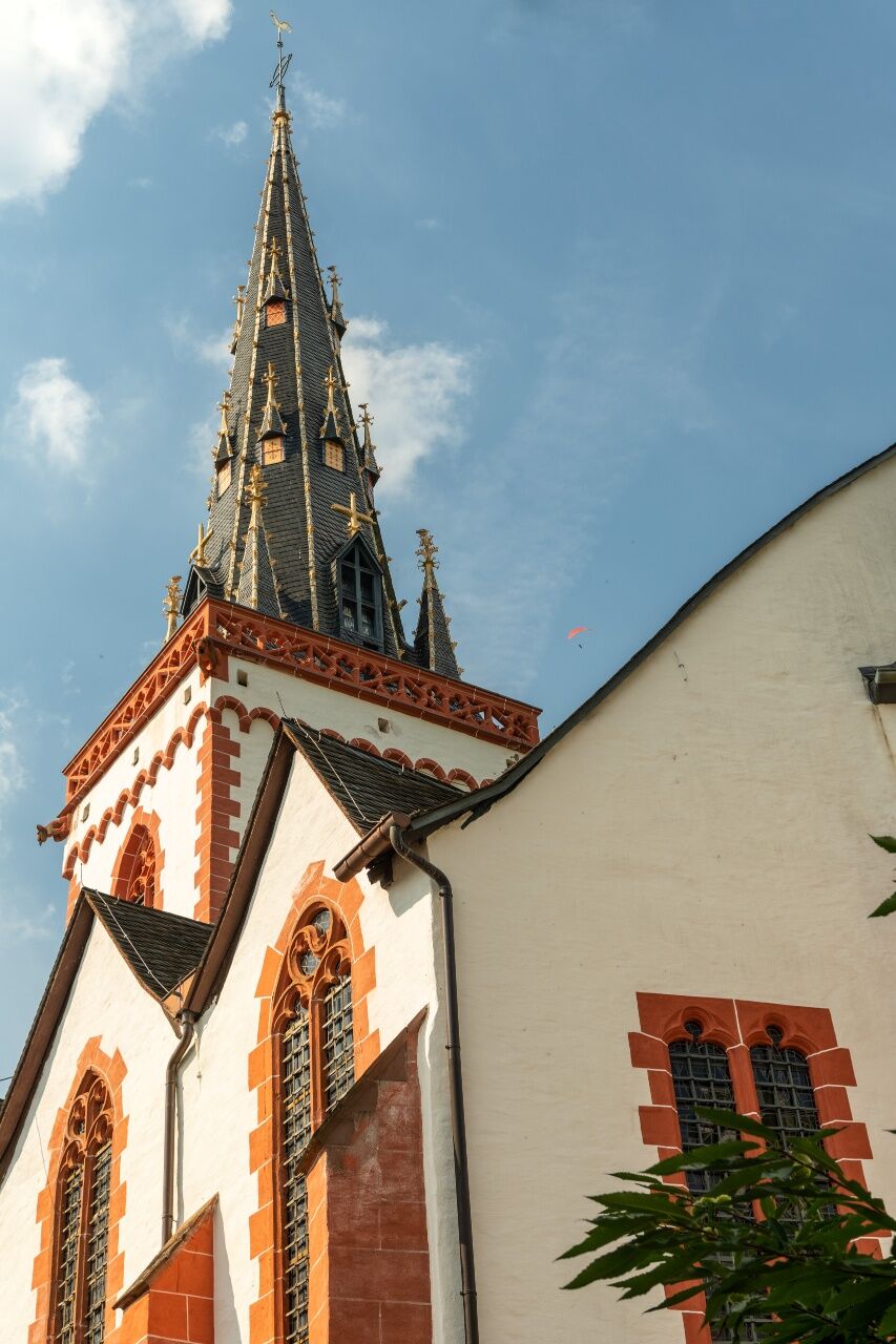
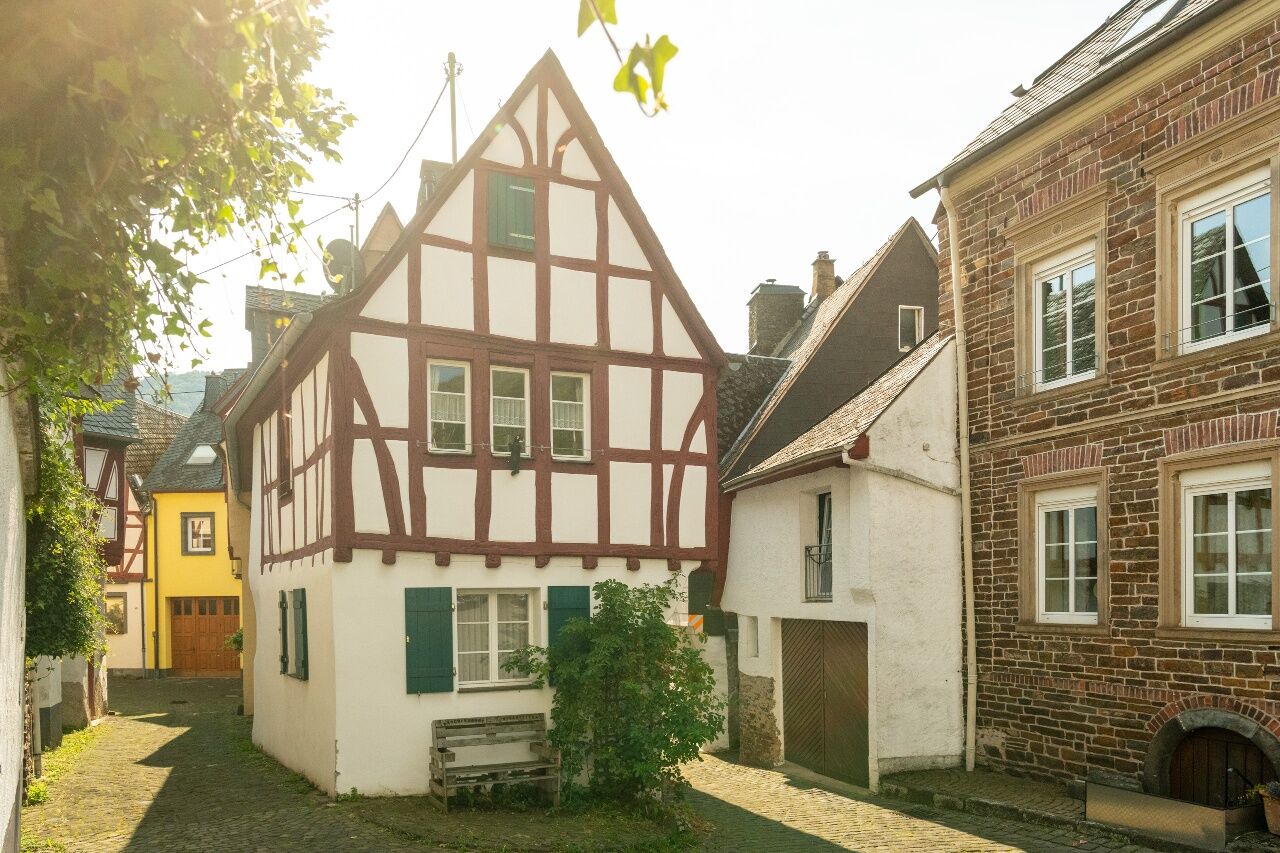
The next descent requires all your attention (and sure-footedness)! This is a steep descent. First, through the lower oak forest, before the environment becomes rocky and more sparse. Once you have reached the Galgenlay hut, you have managed the most challenging section. Climbing enthusiasts can tackle the Calmont climbing trail from here. The trail continues downhill for quite a few meters, always on a narrow slate path. The trail runs parallel to the railway tracks and under the railway bridge. From here, you can also reach the Ediger-Eller railway station on an access route. The Moselsteig Trail continues into the Eller town centre. Through narrow alleyways you hike past a representation of the crucifixion, a chapel and a church, on an old cobbled road out of the town. Following the steep road you reach the vineyards between the town districts of Ediger and Eller. The descent at the endpoint of this leg, Eller, become more challenging again. Directly next to a vineyard, the serpentine path takes you to the lower-lying vineyard path. From here, the access route branches off to the town centre of Ediger at the Moselle bank. Here you will also find the tourist information office and a bus stop.
Leisure Map Moselsteig Trail – Map 3: Zell (Moselle) - Koblenz (Stages 15 - 24), ISBN: 978-3-89637-421-9
Sturdy hiking footwearAppropriate weatherproof hiking gearPicnic lunch
Starting point: Neef via the B 49, between St. Aldegund and Bremm over the Moselle bridge
Destination: Ediger-Eller via the B49 between Alf and Cochem
There are regular connections. Please note that during the school vacations of Rhineland-Palatinate / Saarland, at weekends and on public holidays there may be restrictions on the frequency! Please check the daily timetable on the website of the Verkehrsverbund Region Trier (VRT):
Neef: There is no parking at the station; but there are plenty of parking spaces along the riverbank.
Ediger-Eller: Parking spaces along the B 49/Moselle riverbank
Beliebte Touren in der Nähe
- 5,0
Calmonter Felsensteig
mittelWanderung 6,31 km - 4,0
Moselsteig Etappe 18: Beilstein – Cochem
mittelFernwanderweg 13,6 km - 4,0
Moselsteig Etappe 14: Reil – Zell (Mosel)
leichtFernwanderweg 12,4 km - 4,5
Moselsteig Etappe 12: Ürzig – Traben-Trarbach
mittelFernwanderweg 15,1 km - 5,0
Moselsteig Etappe 13: Traben-Trarbach – Reil
mittelFernwanderweg 15,3 km - 5,0
Moselsteig Etappe 16: Neef – Ediger-Eller
mittelFernwanderweg 11,5 km - 4,0
Moselsteig Etappe 17: Ediger-Eller – Beilstein
mittelFernwanderweg 16,0 km - 4,0
Sterntour rund um Cochem - Tour 1: Rundtour auf dem Mosel-Radweg über Bremm nach Cochem
leichtRadfahren 53,4 km Moselsteig Etappe 15: Zell (Mosel) – Neef
schwerFernwanderweg 19,9 km- 4,0
In der Moselschleife Cochem-Cond
mittelWanderung 11,1 km
Wandern & Tracking


Verpasse keine Angebote und Inspirationen für deinen nächsten Urlaub
Deine E-Mail-Adresse wurde in den Verteiler eingetragen.