


Oberwesel city wall circuit

Let us invite you to visit the historic city wall and experience a journey back in time to the Middle Ages.Our city wall is a monument of special quality. It has been largely preserved in its medieval...
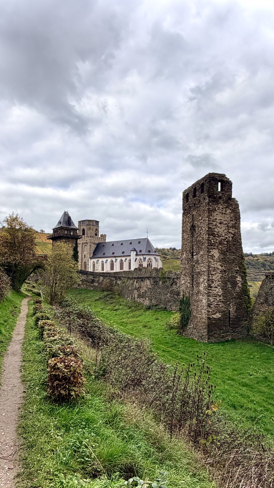
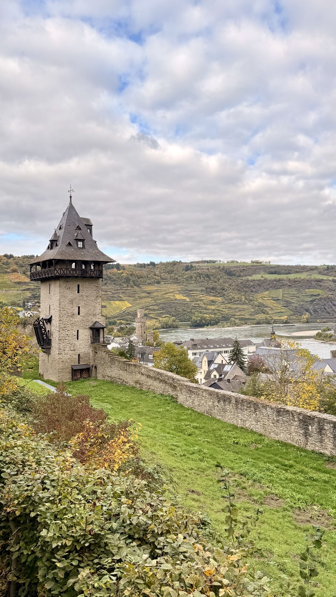
Let us invite you to visit the historic city wall and experience a journey back in time to the Middle Ages.Our city wall is a monument of special quality. It has been largely preserved in its medieval state and is one of the most important and best preserved medieval city fortifications in Germany. In many places you can climb the city wall, climb and visit its fortified towers and walk along the old battlements.The ring wall not only protected against raids, it also provided protection against floods and ice. But the walls were almost as important for the reputation of a city. High walls and towers continued to bear visible witness to the power and wealth of a city. The city wall once had a length of more than 2.5 km. The height varied, depending on the terrain, between 8 and 16 meters. Additional protection was provided by 22 towers, 16 of which are still standing today.
The circular tour takes you along streets, the town wall and paths around the town center of Oberwesel, passing all the towers and churches of the town.
Since you will be walking the city walls, appropriate footwear is recommended.
In winter weather the city wall is closed.
By car via the B9
Bus and train
Parking lot at the train station, Mainzerstr. 6, 55430 Oberwesel
Along the way, discover the many viewpoints with beautiful views of our beautiful city.
Beliebte Touren in der Nähe
- 5,0
Traumschleife Mittelrhein
schwerWanderung 14,7 km - 5,0
Panoramaweg St. Goar
mittelWanderung 8,47 km - 5,0
Kaub - Burg Herzogenstein - Spitznack - Hasenberg
schwerFernwanderweg 22,1 km - 5,0
Traumschleife Oberes Baybachtal
schwerWanderung 15,6 km - 5,0
Traumschleifchen Pfalzblick
leichtWanderung 5,68 km - 4,3
Traumschleifchen Werlauer Pilz
leichtWanderung 5,60 km - 4,7
Schessels Beersche
mittelWanderung 5,44 km - 5,0
Traumschleifchen Baybachquellen
leichtWanderung 6,22 km - 3,0
Traumschleifchen Spitzer Stein
mittelWanderung 6,64 km - 5,0
Kaub - Bacharach - Clemenskapelle - Pfarrkirche St. Martin
mittelFernwanderweg 13,8 km
Wandern & Tracking


Verpasse keine Angebote und Inspirationen für deinen nächsten Urlaub
Deine E-Mail-Adresse wurde in den Verteiler eingetragen.