


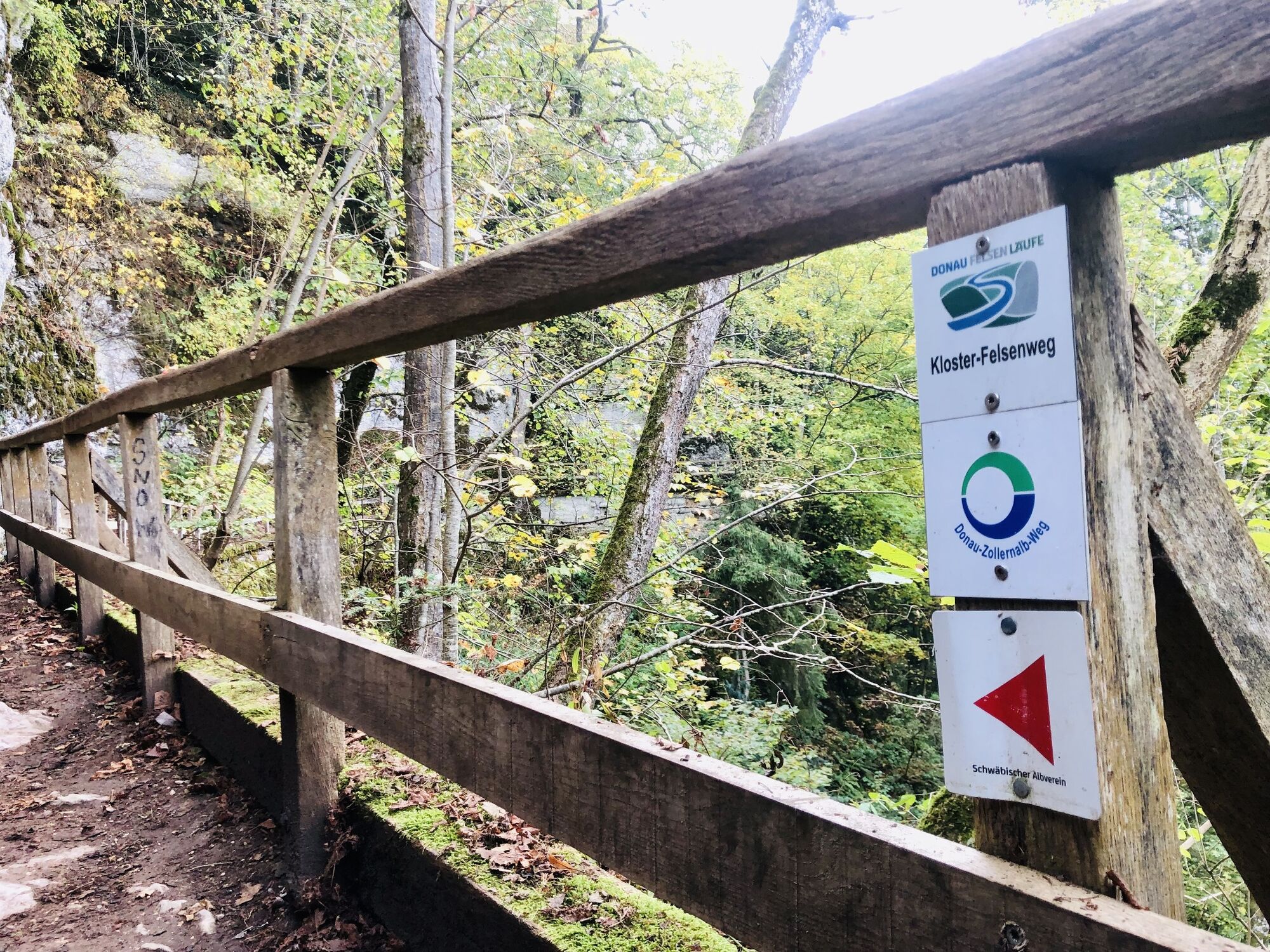
Donaufelsenläufe - Klosterfelsenweg
Fotos unserer User
 © Sulger RainerErstellt am 18.04.2026
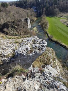
 © Sonja HerdegErstellt am 08.04.2026
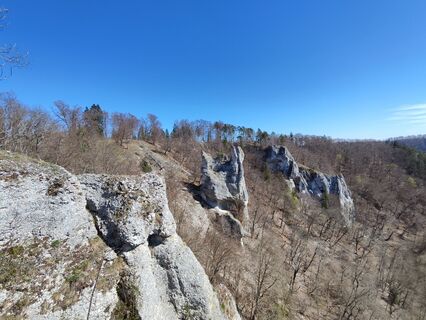 © Sonja HerdegErstellt am 08.04.2026
 © Sonja HerdegErstellt am 08.04.2026
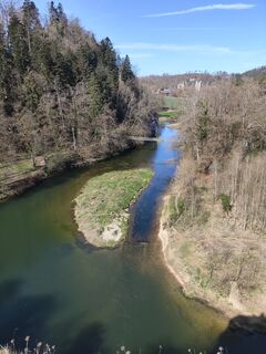 © Sonja HerdegErstellt am 08.04.2026
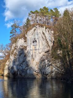
 © KatharinaErstellt am 12.03.2026
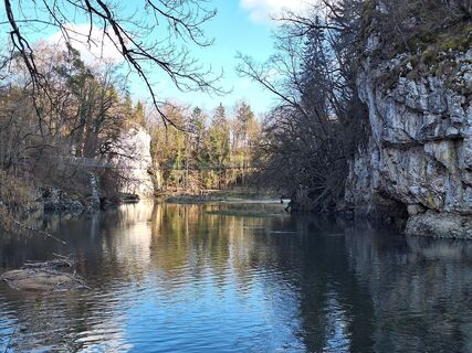 © KatharinaErstellt am 12.03.2026
 © KatharinaErstellt am 12.03.2026
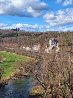 © KatharinaErstellt am 12.03.2026
 © KatharinaErstellt am 12.03.2026
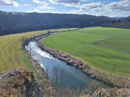 © KatharinaErstellt am 12.03.2026
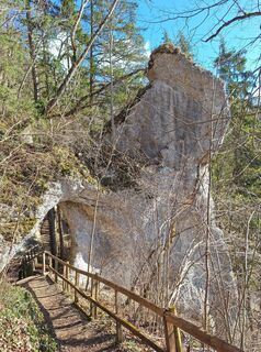 © KatharinaErstellt am 12.03.2026
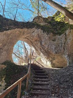 © KatharinaErstellt am 12.03.2026
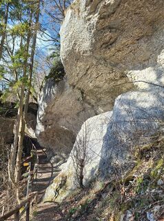 © KatharinaErstellt am 12.03.2026
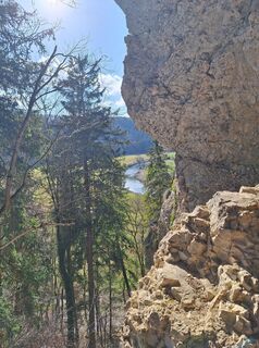 © KatharinaErstellt am 12.03.2026
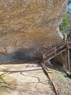 © KatharinaErstellt am 12.03.2026
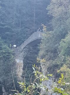
 © Mike LamparterErstellt am 03.10.2025
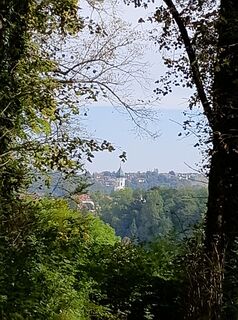 © Mike LamparterErstellt am 03.10.2025
 © Mike LamparterErstellt am 03.10.2025


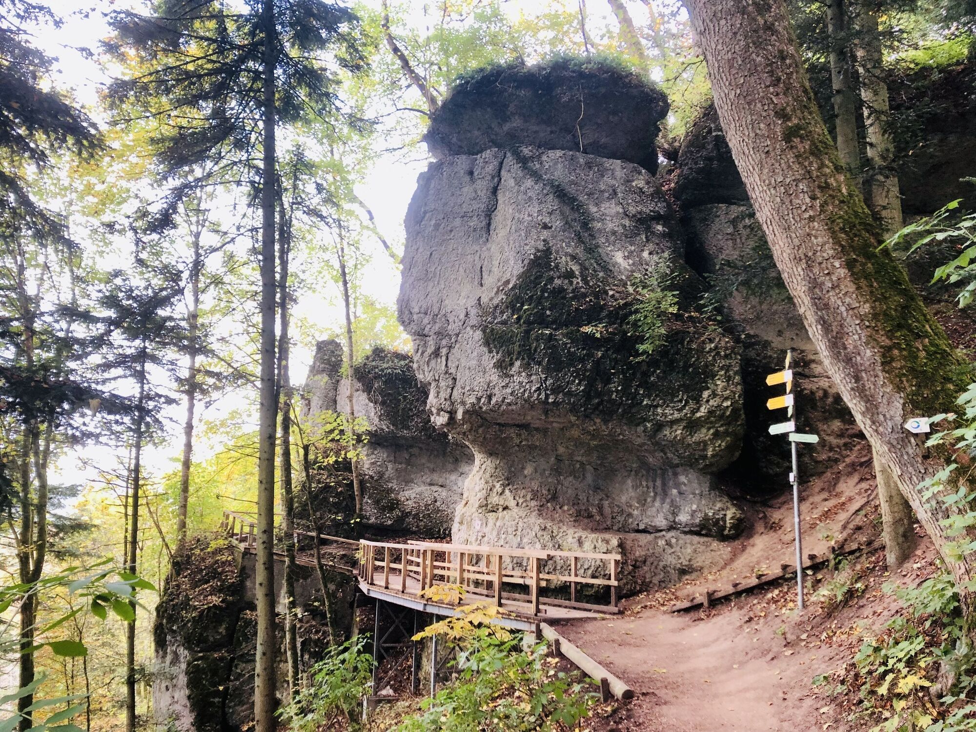
The Klosterfelsenweg does not have its name by chance. In addition to the Princely Park Inzigkofen with its monastery, Amalienfelsen, the suspension bridge and the legendary Devil's Bridge over the Höll...
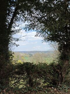
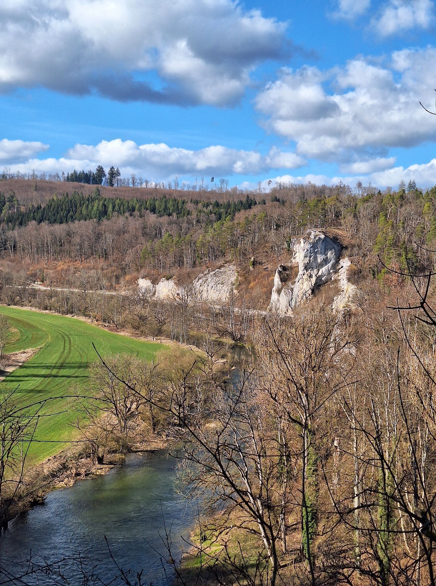
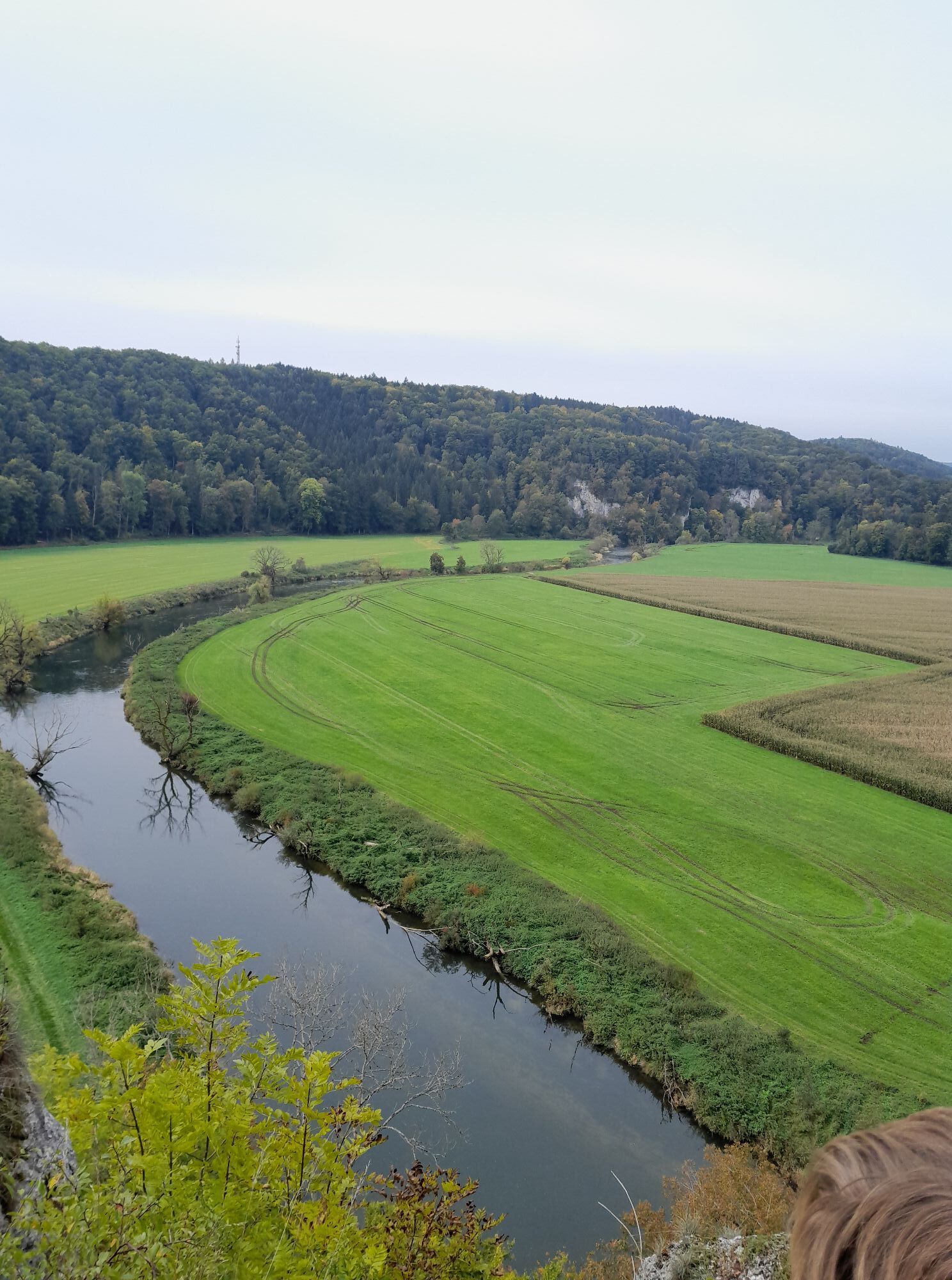
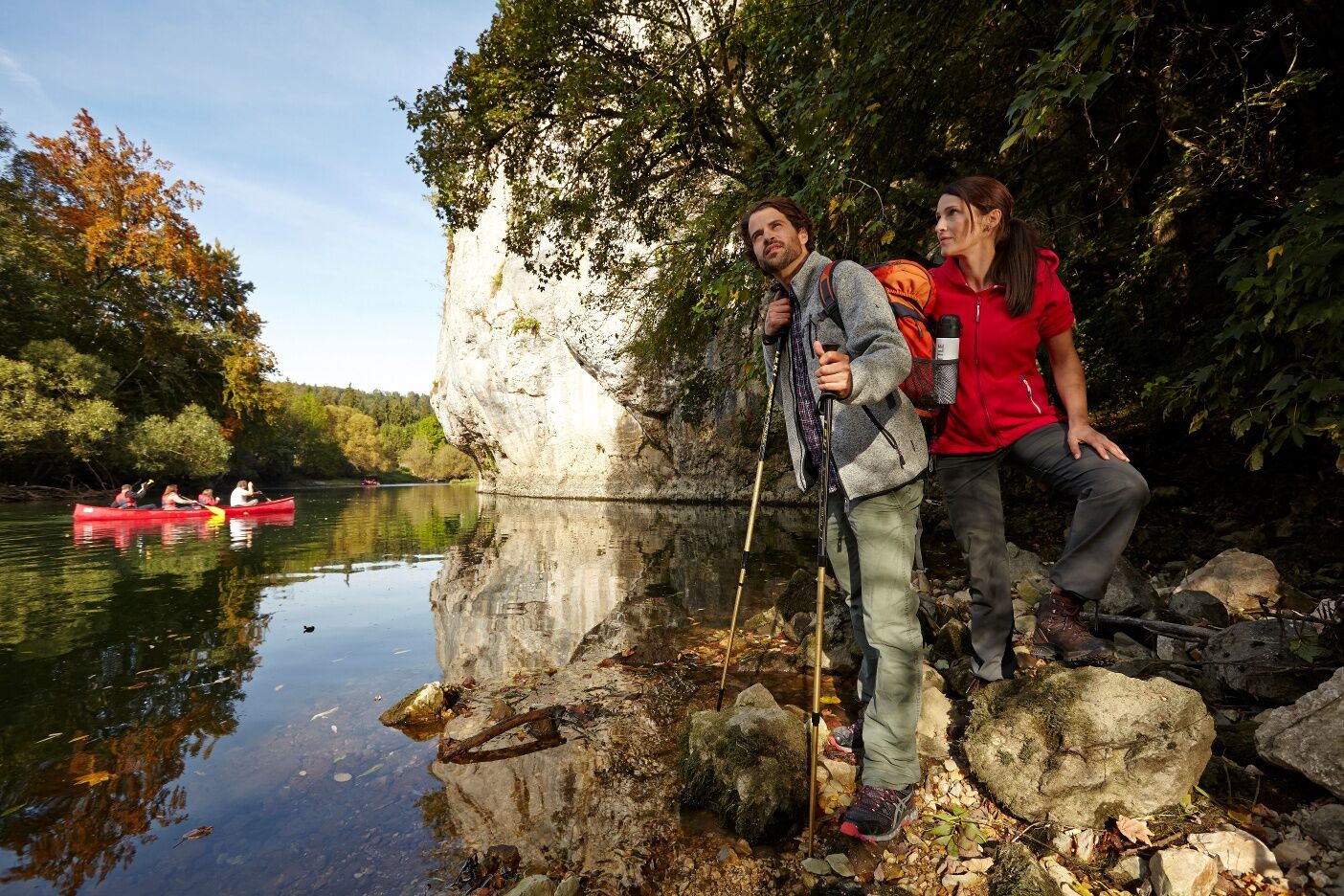
The Klosterfelsenweg does not have its name by chance. In addition to the Princely Park Inzigkofen with its monastery, Amalienfelsen, the suspension bridge and the legendary Devil's Bridge over the Höll Gorge, there are numerous rock formations to marvel at that can be found throughout the landscape. Again and again, you also catch beautiful views of the picturesque floodplain landscape of the Danube, which is a constant companion on the first half of the circular tour.

We start our tour at the gymnasium in Laiz, cross the bridge and walk directly after the bridge over the Inzigkofener Straße to the next intersection and then turn towards the Danube bank. There we stroll along the dike wall in the direction of Inzigkofen and have the Danube constantly in view.
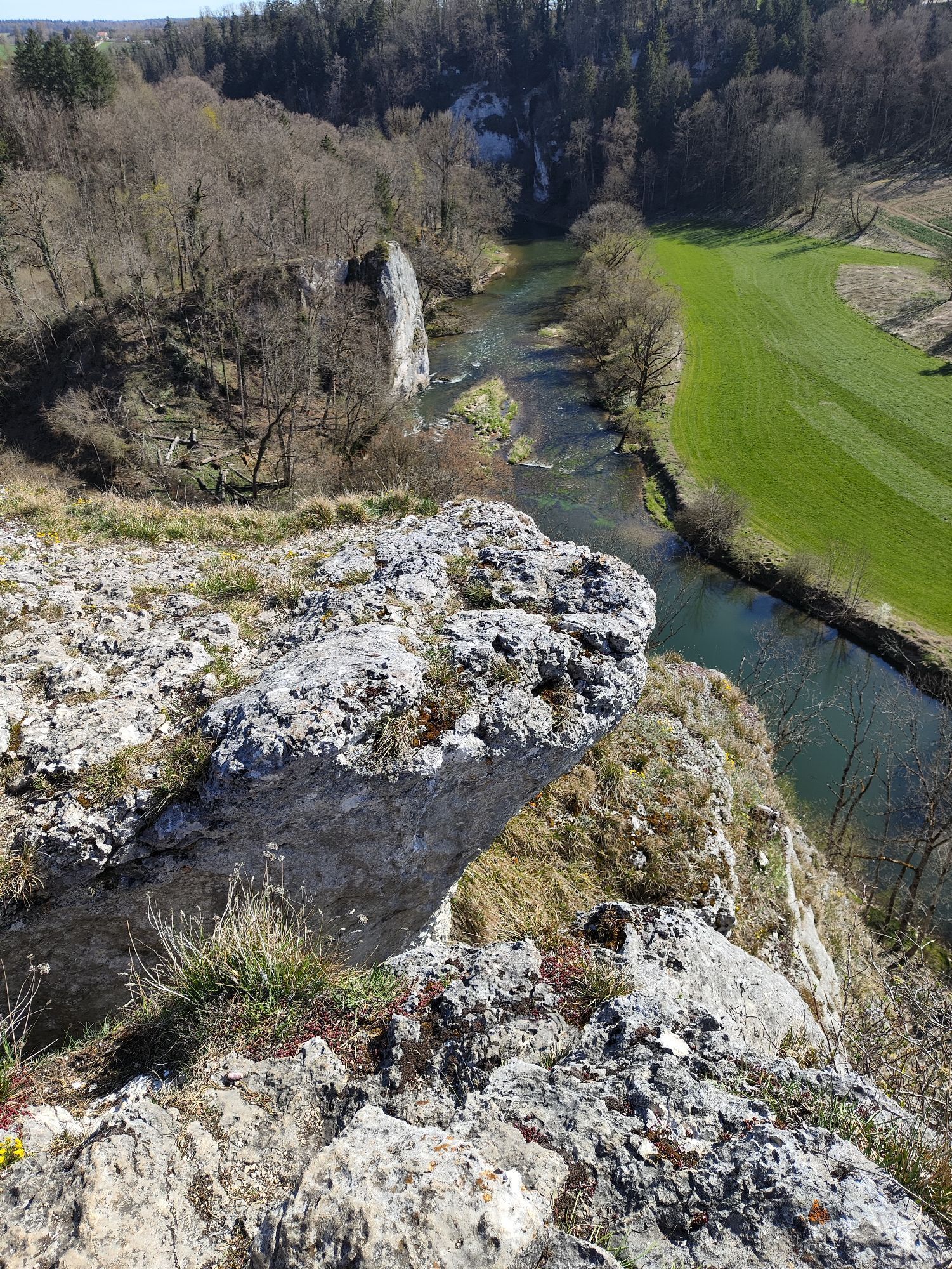
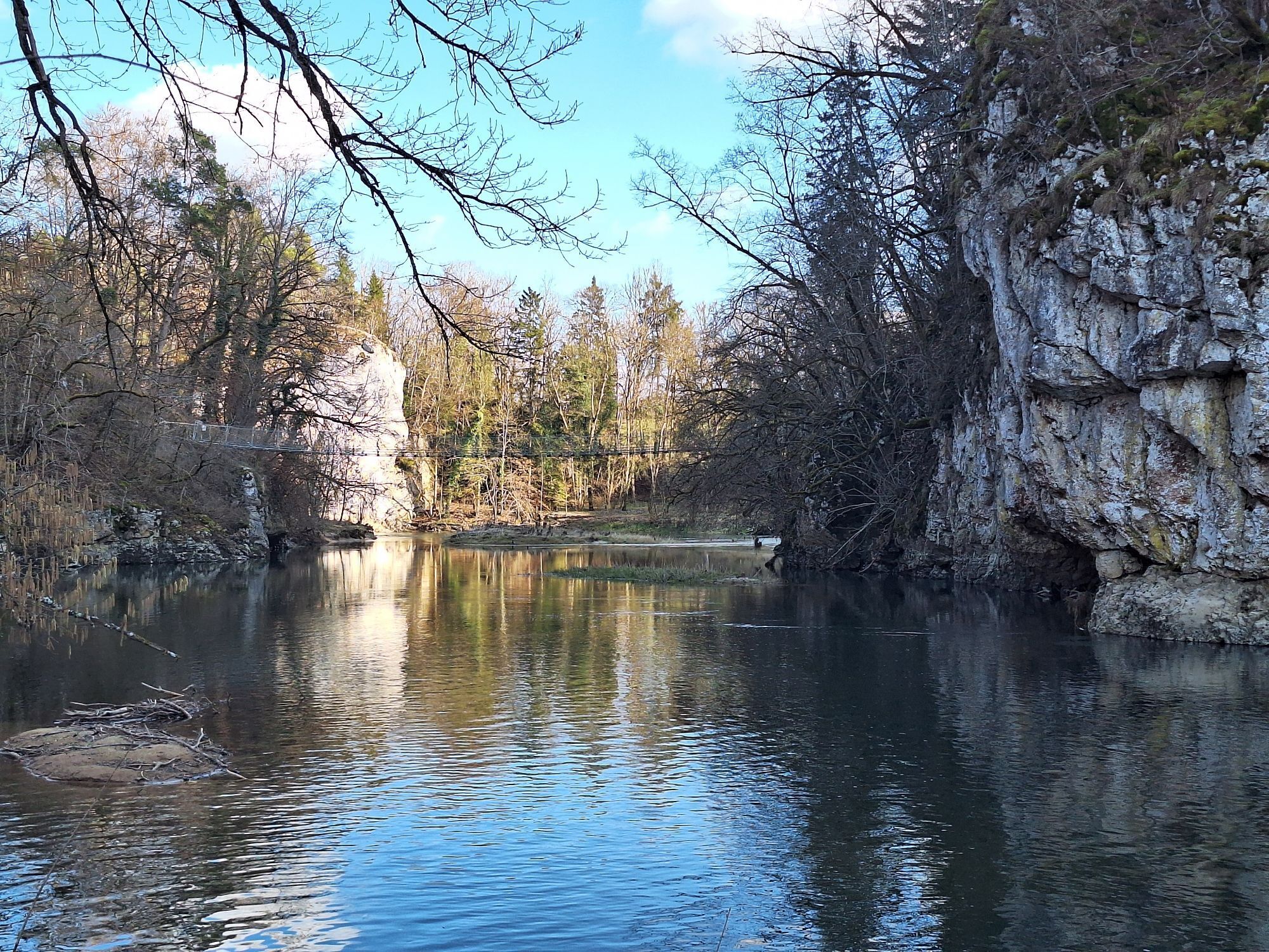
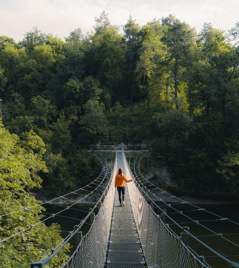
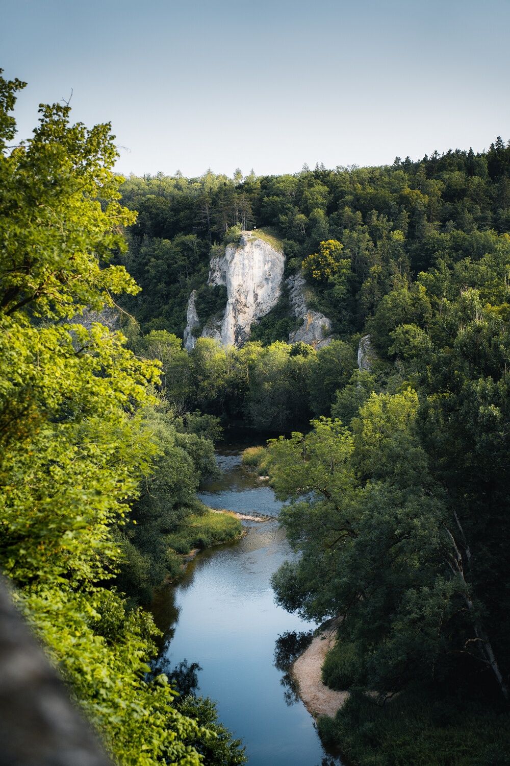
At the end of the dike wall, we follow the gravel path to the turnoff for Amalienfelsen. There are still some meters to climb to the viewpoint on the rock, but the path up is not steep and leads through a sparse forest, which in the last part turns into an avenue of linden trees. At the end of the avenue, a magnificent view from the Amalienfelsen (Amalia Rock) awaits us on the Danube course passing below, in which the princes of the Hohenzollern house used to take their bath on hot summer days. Not to be overlooked from here is also the suspension bridge stretched over the river, which connects the two parts of the Inzigkofer Park.
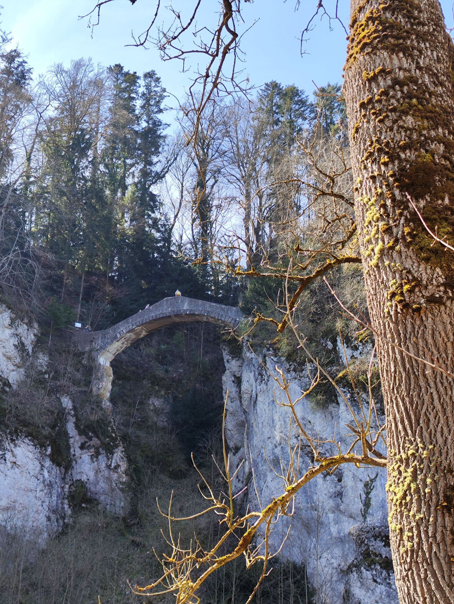
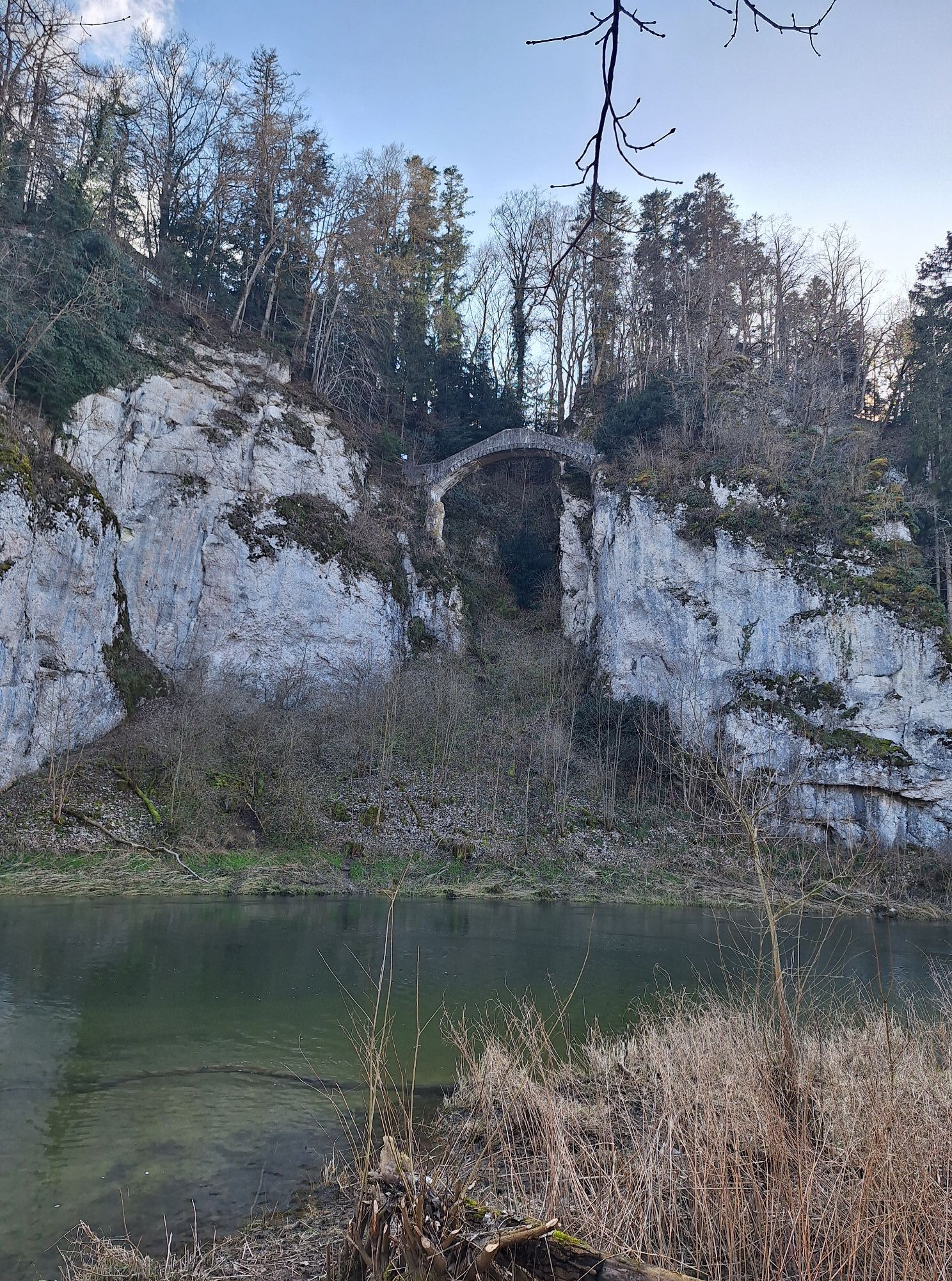
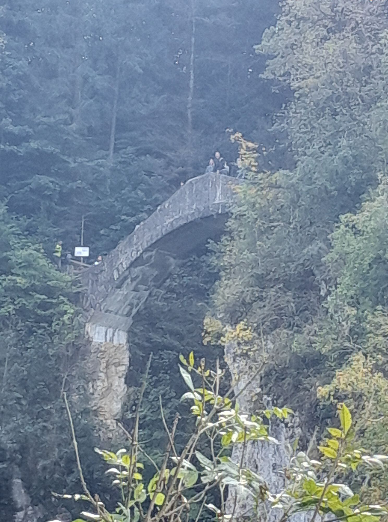
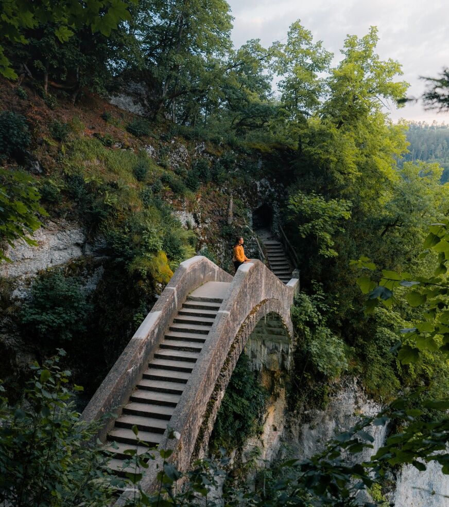
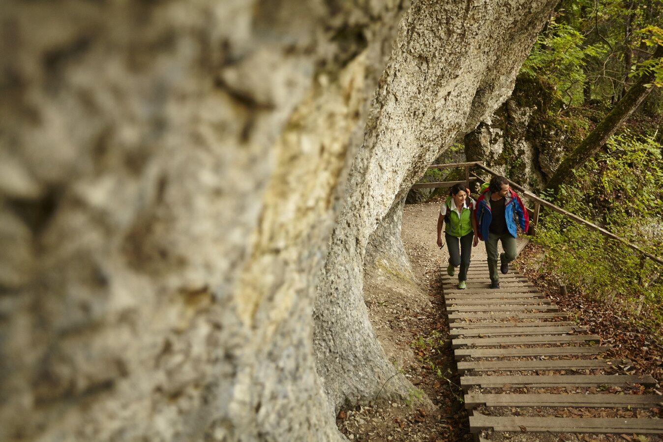
We hike briefly along the banks of the Danube to turn sharply left after about 100 m in the direction of Inzigkofen Monastery. On the way there we have the opportunity to make a short detour up to the prince's monument. We cross the monastery area in northwest direction. About 50 meter after the exit at the monastery wall we turn right and after a few meters we descend to the Devil's Bridge. According to legend, this bridge was built by the devil himself in exchange for a human soul from the inhabitants of Inzigkofen. The first soul to cross the new bridge was supposed to be exchanged. According to the sources, the first soul to cross the bridge was a dog...
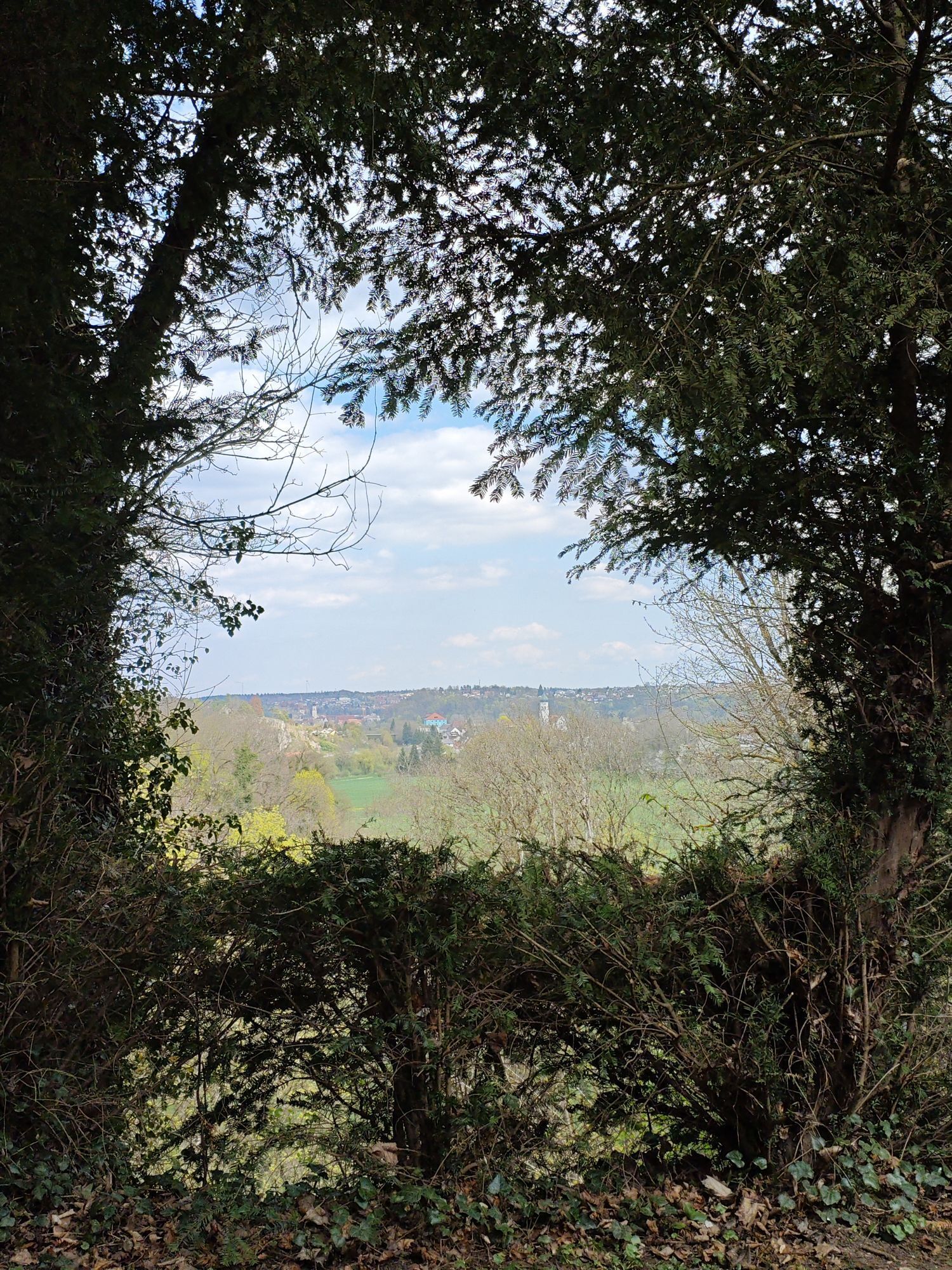
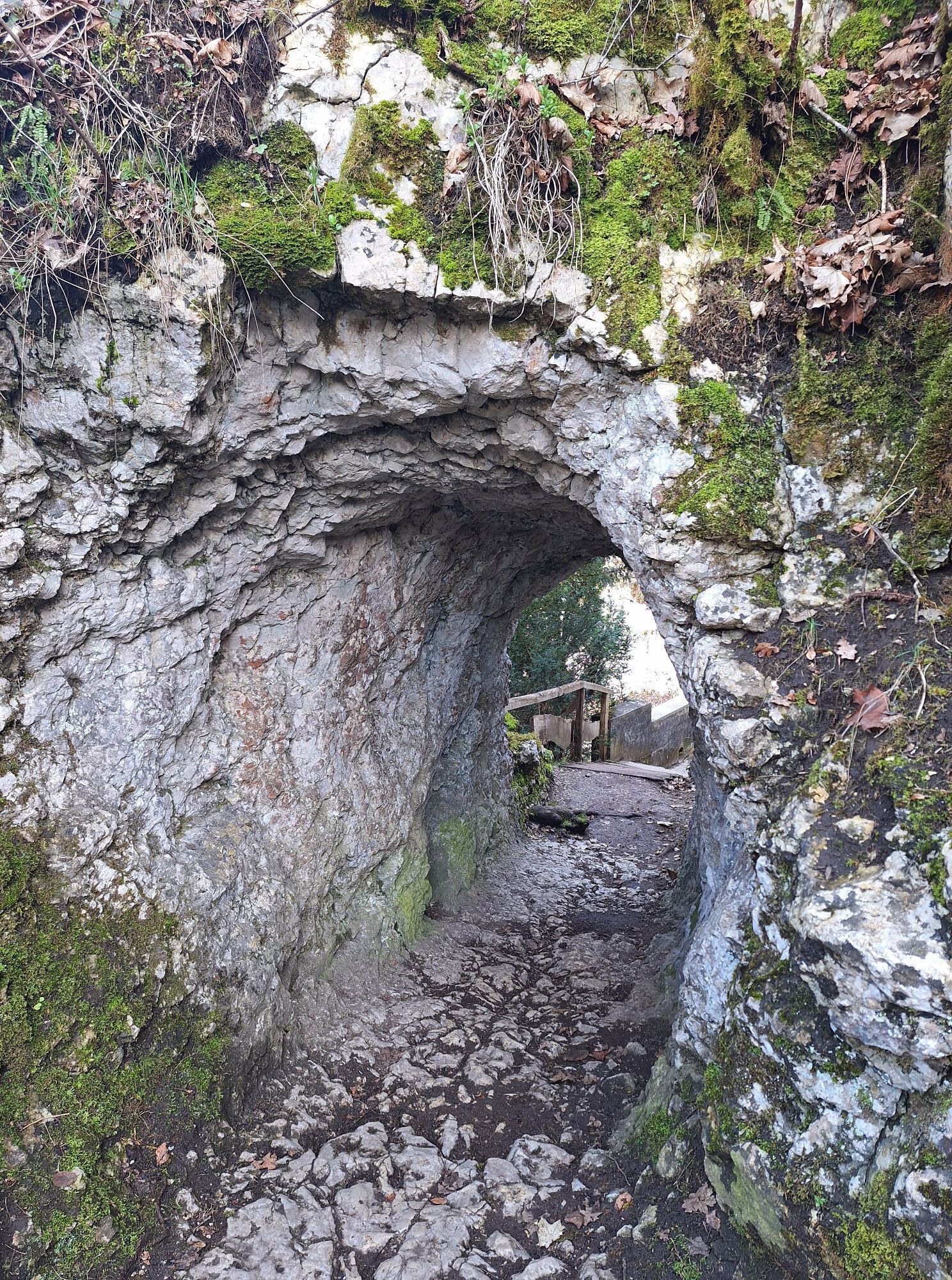
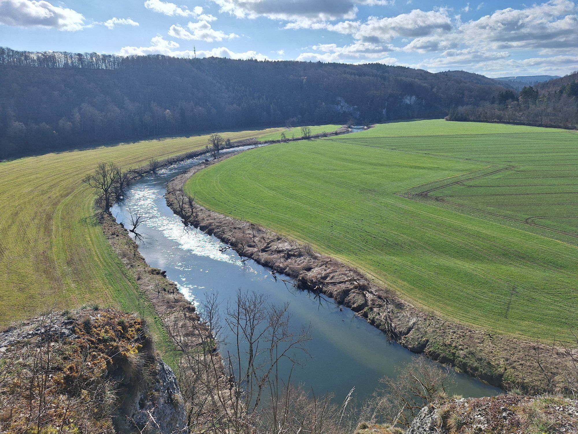
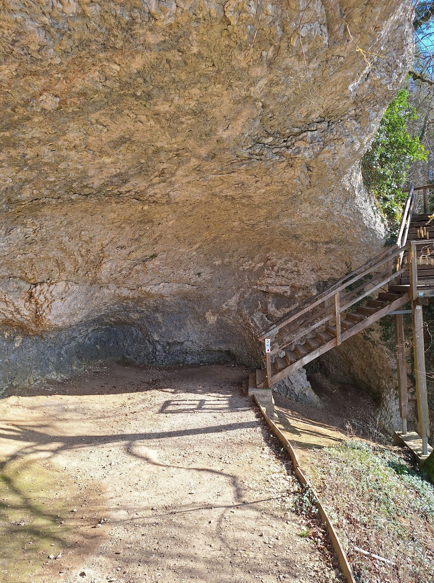
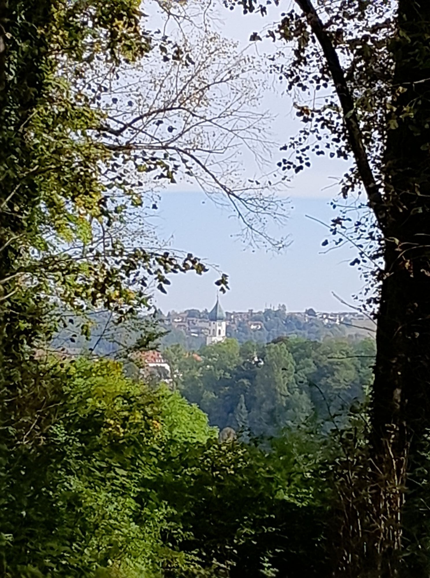
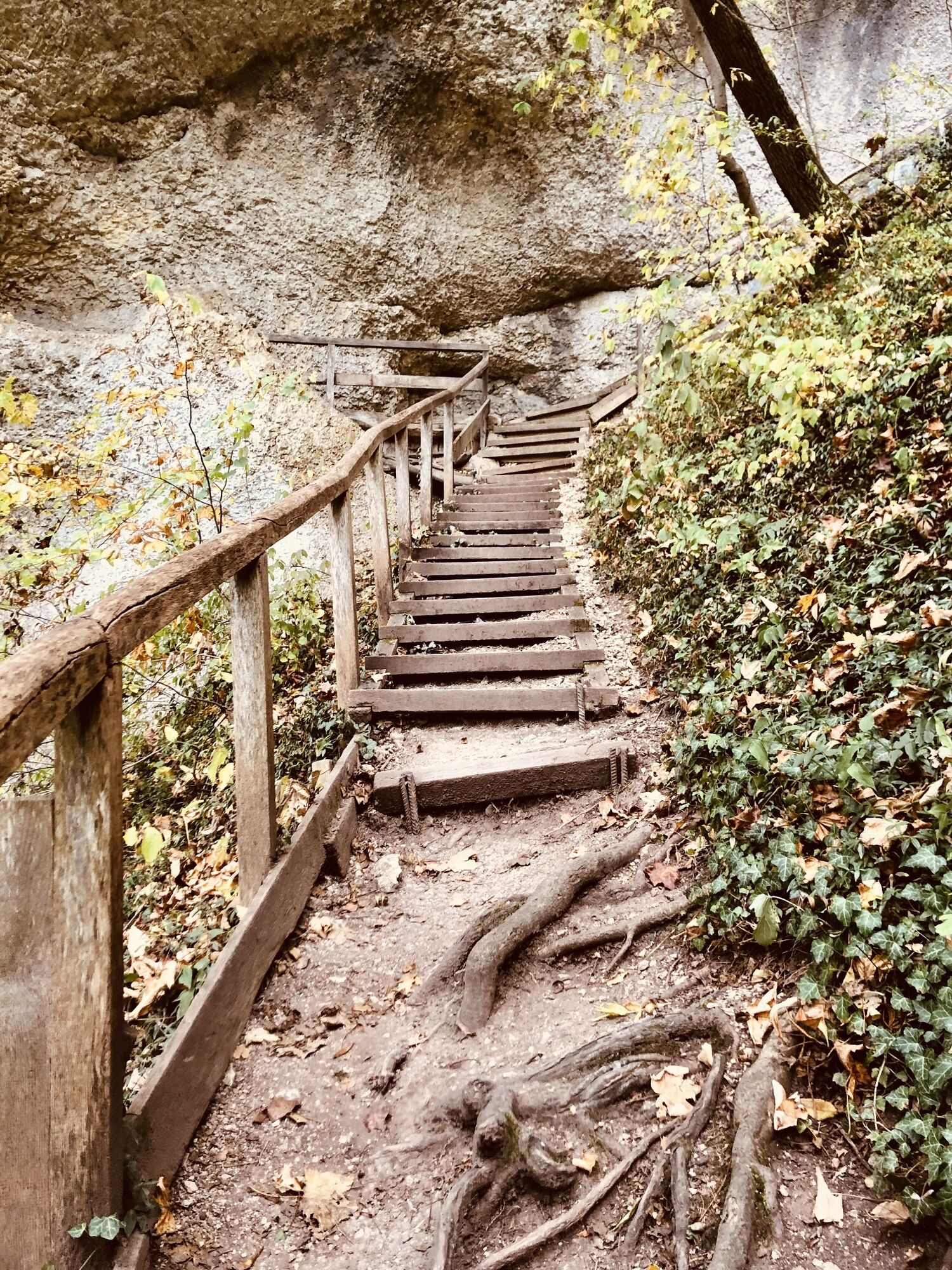
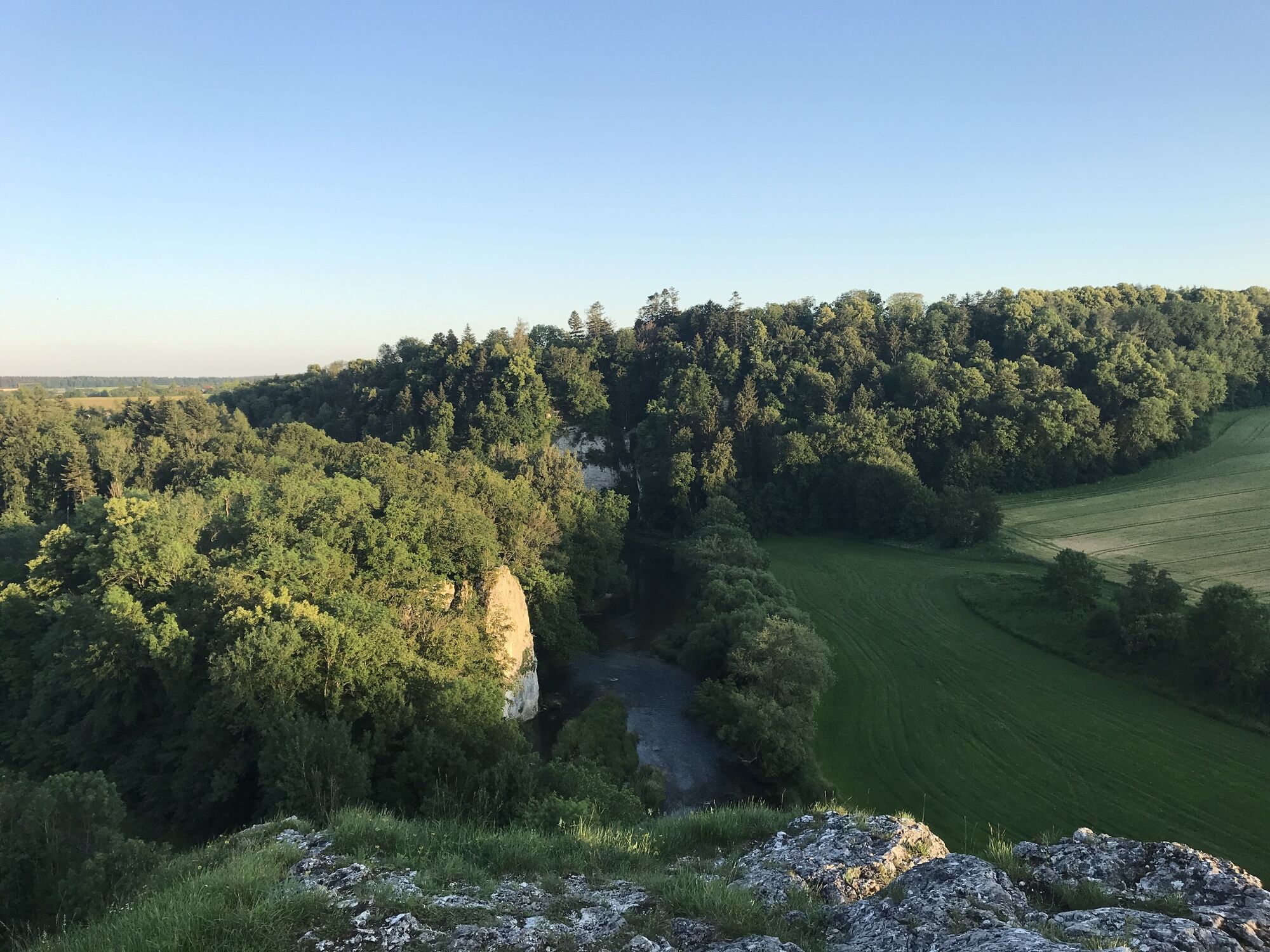
We follow the narrow path to the Känzele and from there enjoy the great view of the Danube valley. We continue on the path to the southeast until the descent into the Danube valley begins. We pass another sight, and marvel at the Inzigkofer Grotten. At the foot of the slope, we turn right and hike within sight parallel to the bank of the Danube. After a short while we reach another bridge that takes us to the other side of the Danube. From the old train station we climb up to Gebrochen Gutenstein, where we can enjoy a unique view of the picturesque floodplain landscape of the Danube. Our path leads us in a northwesterly direction until after a short while we meet railroad tracks. Here we keep to the right in the direction of Zigeunerfels, a rock with a historical background, under which there is also a barbecue area for resting. From the Zigeunerfels we go first on gravel paths, later on forest paths further and further to the east until we meet a paved gravel path, which we follow on the right. We pass four forks until we reach the Erratic Block in a large forest crossing. This erratic boulder made a long journey here on the Rhine glacier many thousands of years ago; today, hikers regularly "prettify" it with cairns.
At this junction, we now orient ourselves southward and continue hiking to our next vantage point, the Gespaltenen Felsen (Split Rock), and enjoy a wonderful view of the Danube valley. After our detour, we continue east and downhill until we reach an open farmland. On this Danube peninsula, which is surrounded by an old arm of the Danube, we walk straight ahead towards the east until we reach the outskirts of Laiz at the Alte Donau parking lot. Here we turn right into the Donautalstraße and follow its course until we turn right after the first underpass of the L277 and immediately left again a few meters further on towards the bank of the Danube. On a narrow riverside path we walk parallel to the tranquil flowing Danube back to our starting point, the gymnasium in Laiz.
Please remember to wear sturdy shoes, weather appropriate clothing and walking sticks if necessary!
Please note that these are natural trails, which can be slippery, possibly icy, in appropriate weather conditions. Due to this, a complete walk on the trail in winter is not recommended for safety reasons!
Navigation: Hauptstraße 52, 72488 Sigmaringen-Laiz
ALTERNATIVE STARTING POINTS:
Parking lot Alte Donau Laiz:
Donautalstraße 23, 72488 Sigmaringen-Laiz
Parking lot Grünes Zentrum/ Nonnenhof:
Winterlinger Str. 9, 72488 Sigmaringen-Laiz Parkplatz Römerhalle Inzigkofen:
Vilsinger Straße 12, 72514 Inzigkofen
Parkplatz Turnhalle Laiz
A short detour across the new suspension bridge in its graceful spider web construction up to the Hermitage with the Meinrad Chapel is very worthwhile - great views included.
Beliebte Touren in der Nähe
- 4,8
Kloster Beuron
mittelWanderung 15,0 km - 5,0
Amalienfels Tour
leichtWanderung 14,6 km Kloster-Felsenweg und Fürstliche Anlagen Inzigkofen
mittelWanderung 20,6 km- 4,7
Donauradweg Etappe 2
mittelRadfahren 62 km Kloster-Felsenweg und Eremitage
leichtWanderung 8,78 km- 5,0
Vom Finstertal zum Korbfelsen und Schloss Werenwag
mittelWanderung 9,85 km Donaufelsenwege zwischen Inzigkofen und Gutenstein
mittelWanderung 20,2 km- 1,0
Thiergarten
leichtWanderung 6,13 km Radregion Sigmaringen Tour 4b - Donautal-Tour
mittelRadfahren 47,5 kmDonaufelsenläufe - Wilde Täler - fürstliche Höhen
mittelWanderung 12,7 km

Wandern & Tracking


Verpasse keine Angebote und Inspirationen für deinen nächsten Urlaub
Deine E-Mail-Adresse wurde in den Verteiler eingetragen.