






Copper City Cycle Route - Inde Valley and Old Town in Stolberg

This route is very varied, but the flow of the Inde remains your constant companion throughout. On the first part of the tour, you pass through the idyllic Inde Valley. You turn towards Büsbach and pass...
This route is very varied, but the flow of the Inde remains your constant companion throughout. On the first part of the tour, you pass through the idyllic Inde Valley. You turn towards Büsbach and pass three mills. These three mills, the Buschmühle, Haumühle and Bocksmühle, stand testament to the tradition of metalworking in Stolberg. Continuing along the Inde, also known locally as the Münsterbach, you enjoy the spectacular riverside landscape until you reach Breinig. Arriving in Breinig, the next highlight of your tour awaits, the picturesque and lively townscape of old Breinig. One particular architectural highlight worth noting is the large collection of quarry stone houses in the heritage-listed street of “Alt Breinig” (Old Breinig). You now cross the Stolberg Woods to return to Stolberg. The medieval castle, hallmark of the city and cultural crossroads of Stolberg and environs, towers above the historic old town. The unusual copper manors and old churches harken back to the “golden age” of Stolberg in the 17th and 18th centuries, when the town was driven by industrial development. Despite its long history of development, the buildings of Stolberg’s old town present a homogeneous style without being monotonous, and present a coherent historical ensemble.
Highlights along the way:
Inde Valley nature reserveZinkhütter Manor HouseStolberg copper millsTatternsteine/”Dwarf Stones”Quarry stone houses in BreinigOld town Stolberg with castle, copper manors and business district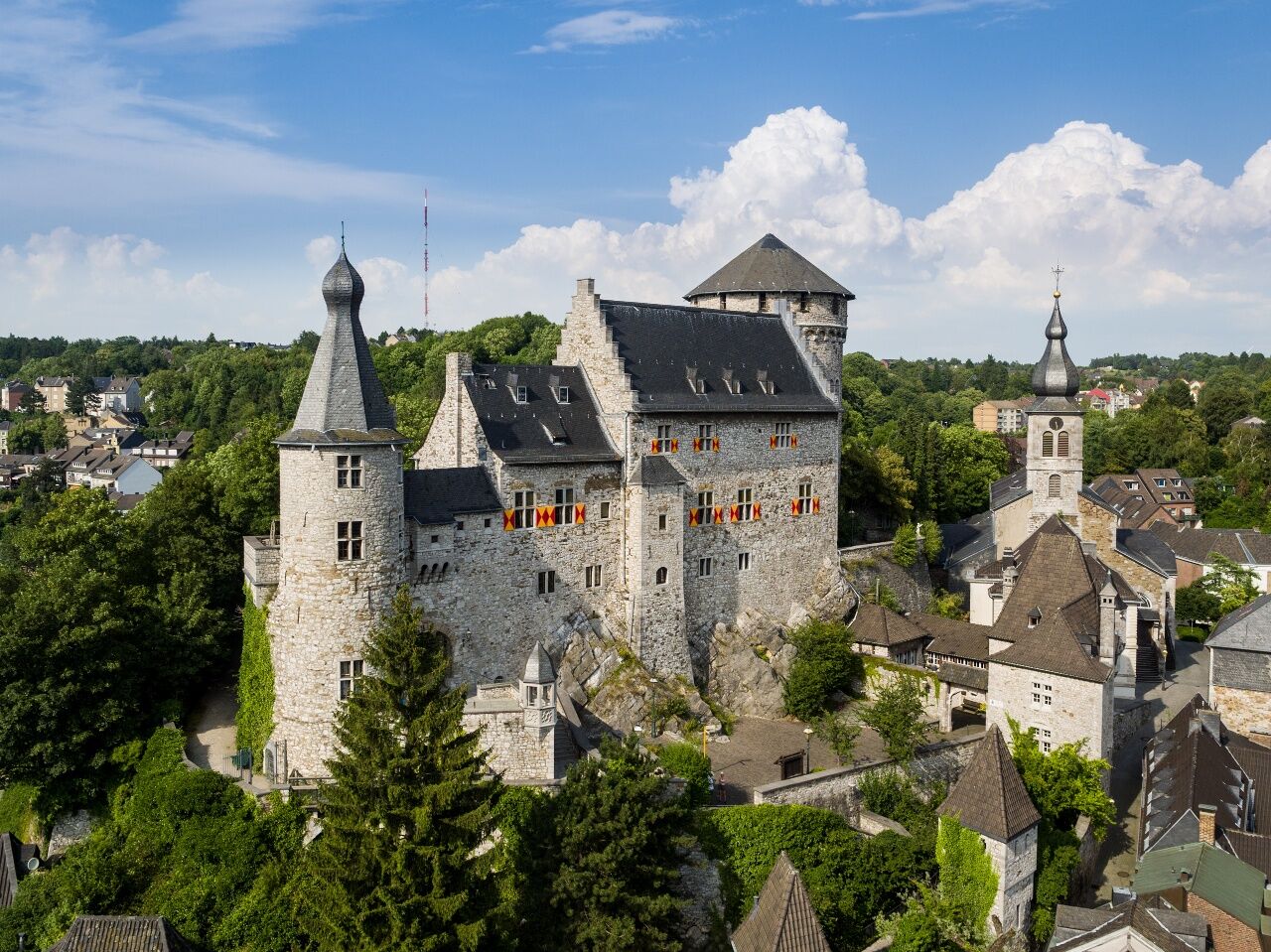

Routing:
The cycle path is signposted throughout via the junction system of the StädteRegion Aachen. Leaving Stolberg train station, the route goes by junctions 87, 91, 1, 93, 92, 91, 87, and then back to the train station. Those looking for a shorter route may go straight from Junction 98 to 92, which shortens the route by 7 km.
Unterwegs mit Pittchen Pedale, Radwandern in der Städteregion Aachen, Radwegekarte On the way with Pittchen Pedale, bicycle touring in StädteRegion Aachen, biking map 1:50.000 with accompanying booklet, Price: 7,50 €, ISBN 978-3-89899-529-0, Meyer & Meyer Verlag
With the weather adapted clothing, enough water and a little food you are well equipped for the tour.
Please stay on the designated paths.
To plan your individual trip by car, use our journey planner and enter “Stolberg (Rheinl.) Bahnhof” as your destination.
Regional trains travel to Stolberg train station. From here, you begin the stage in the direction of the castle.
Your personal connection information with tariff information for travelling by public transport is available at: www.avv.de
Parking is available at the train station in Stolberg. In certain circumstances, parking fees may apply.
For something different, try renting an e-bike! There’s a rental station at the Parkhotel Hammerberg in Stolberg (Hammerberg 11, 52222 Stolberg, www.parkhotel-stolberg.de).

Beliebte Touren in der Nähe
-
4,5
Spuren der Allerseelenschlacht rund um Simonskall
schwerWanderung 17,2 km -
4,0
Durch das Hohe Venn bei Mützenich
mittelWanderung 16,3 km -
3,0
Von Roetgen ins Hohe Venn
mittelWanderung 14,5 km -
4,5
Eifelsteig Etappe 1
leichtWanderung 15,6 km -
4,3
Entlang des Kalltalweges
mittelWanderung 11,4 km -
4,0
Hohes Venn (Region Konzen)
mittelWanderung 14,6 km -
5,0
Drielandenroute
leichtWanderung 16,7 km -
4,0
Rundwege des HBV Schevenhütte; Rundweg 3 Stolberg, Deutschland
mittelWanderung 8,22 km -
5,0
Eifelsteig-Etappe 02
Fernwanderweg 17,3 km -
4,0
Westwall – Hexenplatz Runde von Simmerath
mittelWanderung 11,6 km
Wandern & Tracking


Verpasse keine Angebote und Inspirationen für deinen nächsten Urlaub
Deine E-Mail-Adresse wurde in den Verteiler eingetragen.





